Area Overview for CF43 4HL
Photos of CF43 4HL
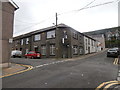
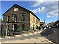
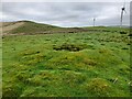
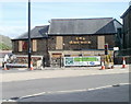
24 photos from this area
Area Information
Key information about the CF43 4HL including its size, population, and administrative classification.
- Area Type
- Postcode
- Area Size
- 6881 m²
- Population
- 1290
- Population Density
- 2209 people/km²
House Prices in CF43 4HL
27
Properties
£51,593
Average Sold Price
£9,500
Lowest Price
£98,000
Highest Price
Showing 27 properties
| Address | Type | Beds | Baths | Last Sale Price | Last Sale Date | |
|---|---|---|---|---|---|---|
| 47 Lake Street, Ferndale, CF43 4HL | Terraced | 3 | 1 | £96,000 | Nov 2024 | |
| 25 Lake Street, Ferndale, CF43 4HL | Terraced | 3 | 1 | £72,000 | Dec 2023 | |
| 39 Lake Street, Ferndale, CF43 4HL | Terraced | 2 | 1 | £68,000 | Mar 2020 | |
| 48 Lake Street, Ferndale, CF43 4HL | house | - | - | £75,000 | Jul 2019 | |
| 31 Lake Street, Ferndale, CF43 4HL | house | - | - | £40,000 | Apr 2017 | |
| 49 Lake Street, Ferndale, CF43 4HL | house | 4 | - | £92,000 | Apr 2012 | |
| 30 Lake Street, Ferndale, CF43 4HL | Terraced | 2 | 1 | £58,000 | Sep 2008 | |
| 24 Lake Street, Ferndale, CF43 4HL | Terraced | - | - | £98,000 | Apr 2008 | |
| 34 Lake Street, Ferndale, CF43 4HL | house | - | - | £37,500 | Sep 2003 | |
| 45 Lake Street, Ferndale, CF43 4HL | Terraced | - | - | £25,000 | Dec 2002 |
Page 1 of 3
Energy Efficiency in CF43 4HL
Amenities
Schools
| Rank | School | Type | Entry gender | Ages |
|---|
Explore more schools in this area
Go to Schools tabDemographics
Household Size
One person
most common
Accommodation Type
Houses
most common
Tenure
72
majority
Ethnic Group
White
most common
Religion
N/A
most common
Household Composition
N/A
most common
Age
47
median
Adults (30-64 years)
most common
Household Deprivation
N/A
with no deprivation
NS-SEC
26
in Lower managerial occupations
Explore more demographic insights in this area
Go to Demographics tabPlanning
Planning Constraints
- Flood RiskPremium
- Ramsar Wetland SitesPremium
- Area of Outstanding Natural BeautyPremium
- Protected Nature ReservePremium
- Protected WoodlandPremium
- Crime RiskPremium