Area Overview for CF43 3YF
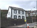
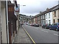
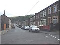
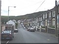
Photos of CF43 3YF
Area Information
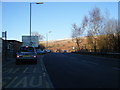
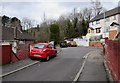
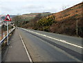
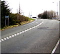
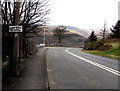
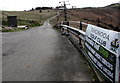
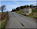
CF43 3YF is a small residential postcode nestled in the Rhondda Valley, Wales, with a population of 1,222. Historically shaped by coal mining, the area was established in the 1870s around Tylorstown Colliery, which gave rise to the community. Today, it is a quiet, compact cluster of homes surrounded by nearby villages such as Penrhys, Ferndale, and Stanleytown. The area’s character is steeped in industrial heritage, with landmarks like the Tylorstown Welfare Hall, a restored miners’ institute now serving as a community hub. Recent infrastructure, like the Rhondda by-pass, has eased local traffic, though the village retains a close-knit feel. Residents benefit from proximity to retail outlets, rail stations, and schools, while the landscape remains relatively unspoiled. Living here offers a blend of historical significance and practical modern amenities, appealing to those seeking a peaceful yet connected Welsh community.
- Area Type
- Postcode
- Area Size
- Not available
- Population
- 1222
- Population Density
- 1706 people/km²
The property market in CF43 3YF is defined by its small size and focus on houses, with 41% of homes owned by residents. This suggests a modest housing stock, likely comprising detached or semi-detached properties typical of rural or semi-urban areas. The lower home ownership rate indicates a significant rental market, which may influence property availability and pricing. Given the area’s compact nature, buyers should consider the limited scope for expansion or development. The presence of houses rather than flats or apartments aligns with a preference for private, spacious living. For those seeking property, the market may offer a blend of traditional homes with potential for renovation or modernization. However, the small population and proximity to larger towns like Rhondda Cynon Taf mean competition for homes could be limited, though local demand may be constrained by the area’s size.
House Prices in CF43 3YF
No properties found in this postcode.
Energy Efficiency in CF43 3YF
CF43 3YF offers a mix of retail and leisure amenities within practical reach. Nearby supermarkets include Lidl Tylorstown, Morrisons Daily, and Asda Tonypandy, providing daily essentials. The area’s rail stations connect to local towns, though the absence of a direct rail link to major cities may require additional travel. Cultural and community hubs include the Tylorstown Welfare Hall, a historic French Baroque-style building now used for events and gatherings, and the Rhondda Fach Sports Centre, which features a gym and squash court. The village’s historical landmarks, such as Holy Trinity Church, add to its character. While the area lacks large-scale entertainment venues, its proximity to nature and smaller community spaces fosters a relaxed lifestyle. Residents benefit from a balance of practical amenities and a sense of local identity, making it suitable for those valuing convenience and heritage.
Amenities
Schools
Nearby schools in CF43 3YF include Tir Gwaidd Nursery School and Penrhys Primary, Infant, and Junior Schools. These institutions provide education from nursery through to primary levels, covering early years to key stage 2. The presence of multiple schools suggests a focus on local education, though no Ofsted ratings are provided in the data. Families may benefit from the variety of school types, which could offer different teaching approaches or facilities. The proximity of these schools to residential areas makes them accessible for local children, reducing the need for long commutes. However, the lack of secondary schools in the immediate area may require students to travel to nearby towns for further education. The availability of early years provision and primary schooling is a key consideration for families prioritising convenience in their choice of residence.
| Rank | School | Type | Entry gender | Ages |
|---|
Explore more schools in this area
Go to Schools tabDemographics
The population of CF43 3YF has a median age of 47, with the majority of residents aged between 30 and 64. This suggests a mature, stable community with a focus on family and long-term settlement. Home ownership stands at 41%, indicating a mix of owner-occupied properties and rental housing. The predominant accommodation type is houses, reflecting a suburban or semi-rural character. The dominant ethnic group is White, with no specific data provided on other demographics. The relatively low home ownership rate may imply a higher proportion of renters, potentially influencing local housing dynamics. The age profile suggests a community with established residents and fewer younger families, which could affect local services and amenities. Overall, the area appears to be a place of continuity, where historical roots meet contemporary living needs.
Household Size
Accommodation Type
Tenure
Ethnic Group
Religion
Household Composition
Age
Household Deprivation
NS-SEC
Explore more demographic insights in this area
Go to Demographics tabPlanning
Planning Constraints
- Flood RiskPremium
- Ramsar Wetland SitesPremium
- Area of Outstanding Natural BeautyPremium
- Protected Nature ReservePremium
- Protected WoodlandPremium
- Crime RiskPremium