Area Overview for CF43 3BP
Photos of CF43 3BP
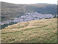

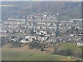

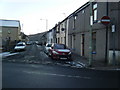
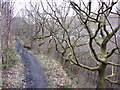
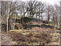
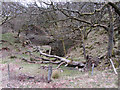
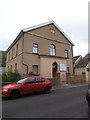

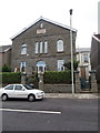
55 photos from this area
Area Information
Key information about the CF43 3BP including its size, population, and administrative classification.
- Area Type
- Postcode
- Area Size
- 2.5 hectares
- Population
- 1275
- Population Density
- 404 people/km²
House Prices in CF43 3BP
19
Properties
£54,652
Average Sold Price
£26,325
Lowest Price
£99,000
Highest Price
Showing 19 properties
| Address | Type | Beds | Baths | Last Sale Price | Last Sale Date | |
|---|---|---|---|---|---|---|
| 131 East Road, Tylorstown, Ferndale, CF43 3BP | Terraced | 2 | 1 | £99,000 | Sep 2025 | |
| 127 East Road, Tylorstown, Ferndale, CF43 3BP | Terraced | 2 | 1 | £84,995 | Dec 2024 | |
| 132 East Road, Tylorstown, Ferndale, CF43 3BP | Terraced | 2 | 1 | £65,500 | Jul 2024 | |
| 137 East Road, Tylorstown, Ferndale, CF43 3BP | house | 2 | 1 | £44,500 | Feb 2024 | |
| 130 East Road, Tylorstown, Ferndale, CF43 3BP | house | - | - | £80,000 | Mar 2022 | |
| 126 East Road, Tylorstown, Ferndale, CF43 3BP | Terraced | 2 | 1 | £57,000 | Jul 2017 | |
| 138 East Road, Tylorstown, Ferndale, CF43 3BP | Terraced | 2 | - | £33,000 | Feb 2016 | |
| Autumn Cottage, 143-144 East Road, Tylorstown, Ferndale, CF43 3BP | Semi-detached | 4 | 2 | £52,500 | Jul 2009 | |
| 133 East Road, Tylorstown, Ferndale, CF43 3BP | Terraced | 2 | 1 | £51,000 | Feb 2007 | |
| 135 East Road, Tylorstown, Ferndale, CF43 3BP | house | - | - | £32,000 | Apr 2004 |
Page 1 of 2
Energy Efficiency in CF43 3BP
Amenities
Schools
| Rank | School | Type | Entry gender | Ages |
|---|
Explore more schools in this area
Go to Schools tabDemographics
Household Size
One person
most common
Accommodation Type
Houses
most common
Tenure
58
majority
Ethnic Group
White
most common
Religion
N/A
most common
Household Composition
N/A
most common
Age
47
median
Adults (30-64 years)
most common
Household Deprivation
N/A
with no deprivation
NS-SEC
17
in Lower managerial occupations
Explore more demographic insights in this area
Go to Demographics tabPlanning
Planning Constraints
- Flood RiskPremium
- Ramsar Wetland SitesPremium
- Area of Outstanding Natural BeautyPremium
- Protected Nature ReservePremium
- Protected WoodlandPremium
- Crime RiskPremium