Area Overview for CF42 6XA
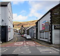
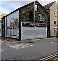
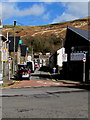
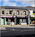
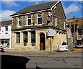
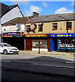
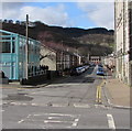
Photos of CF42 6XA

Area Information
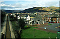
CF42 6XA is a small residential postcode area in Wales, nestled within the Rhondda Fawr valley. With a population of 1,537 and a density of 206 people per square kilometre, it reflects a compact, closely knit community. Historically, the area was shaped by coal mining, transforming scattered farmhouses into a densely populated industrial settlement by the late 19th century. Though mining declined by the late 20th century, the area retains its industrial heritage, now functioning as a cultural and social hub. The village of Treorchy, which includes nearby settlements like Cwmparc and Ynyswen, is home to institutions such as the Treorchy Male Choir and Park and Dare Theatre, which continue to define its character. Living here means being part of a community that balances its industrial past with modern amenities. Residents benefit from proximity to rail networks, retail outlets, and local cultural venues, all within practical reach. The area’s small scale and historical roots create a distinct atmosphere, blending tradition with contemporary needs.
- Area Type
- Postcode
- Area Size
- Not available
- Population
- 1537
- Population Density
- 206 people/km²
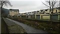
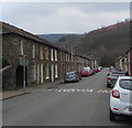
CF42 6XA is predominantly an owner-occupied area, with 65% of homes owned by their occupants. The housing stock is largely composed of houses, which is unusual for many modern urban areas but aligns with the region’s historical development as a mining settlement. This suggests a mix of older, possibly larger properties that may have been built during the industrial era. The small size of the postcode area means the housing market is likely limited in scale, with fewer properties available compared to larger towns. For buyers, this could mean a competitive market for owner-occupied homes, particularly those seeking traditional housing. The lack of rental data implies that the area may not be a major focus for investors, though the presence of local amenities could support long-term residency.
House Prices in CF42 6XA
No properties found in this postcode.
Energy Efficiency in CF42 6XA
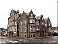
The lifestyle in CF42 6XA is shaped by its proximity to essential amenities and historical character. Within practical reach are retail outlets such as Co-op Treorchy, Spar, and Iceland Treorchy, offering daily necessities. The rail network, with five stations including Treorchy and Ynyswen, provides convenient transport links for commuting or leisure travel. The area’s cultural heritage is evident in institutions like the Park and Dare Theatre and the Treorchy Male Choir, which contribute to a vibrant local scene. While the data does not detail parks or recreational spaces, the historical role of the area as a social hub suggests opportunities for community engagement. The blend of retail convenience, cultural offerings, and transport options creates a functional yet characterful environment for residents.
Amenities
Schools
The nearest school to CF42 6XA is Parc Primary School, which is categorised as an 'other' school type in the data. No further details about its Ofsted rating or curriculum are provided. The absence of secondary schools or additional educational institutions in the immediate area means families may need to look beyond the postcode for comprehensive schooling options. This could be a consideration for parents prioritising proximity to schools, though the presence of a primary school indicates some local educational infrastructure. The lack of specific data on school performance or facilities means prospective residents should investigate further to understand the full range of educational opportunities available.
| Rank | School | Type | Entry gender | Ages |
|---|
Explore more schools in this area
Go to Schools tabDemographics
The population of CF42 6XA has a median age of 47, with the majority of residents aged between 30 and 64 years. This suggests a community with a strong presence of working-age adults and families. Home ownership is high at 65%, indicating a stable residential base, while the predominant accommodation type is houses, reflecting a more traditional housing stock. The predominant ethnic group is White, though specific data on diversity or deprivation is not available in the provided information. The age profile and home ownership figures suggest a mature, settled population with long-term ties to the area. The absence of detailed diversity statistics means the community’s demographic composition remains largely unexplored in this context.
Household Size
Accommodation Type
Tenure
Ethnic Group
Religion
Household Composition
Age
Household Deprivation
NS-SEC
Explore more demographic insights in this area
Go to Demographics tabPlanning
Planning Constraints
- Flood RiskPremium
- Ramsar Wetland SitesPremium
- Area of Outstanding Natural BeautyPremium
- Protected Nature ReservePremium
- Protected WoodlandPremium
- Crime RiskPremium