Area Overview for CF42 6LE
Photos of CF42 6LE
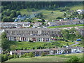
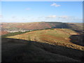
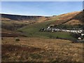
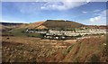
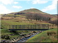

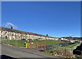
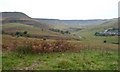
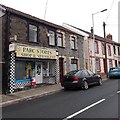
57 photos from this area
Area Information
Key information about the CF42 6LE including its size, population, and administrative classification.
- Area Type
- Postcode
- Area Size
- 6908 m²
- Population
- 1537
- Population Density
- 206 people/km²
House Prices in CF42 6LE
38
Properties
£48,758
Average Sold Price
£10,000
Lowest Price
£80,000
Highest Price
Showing 38 properties
| Address | Type | Beds | Baths | Last Sale Price | Last Sale Date | |
|---|---|---|---|---|---|---|
| 40 Park Road, Cwm Parc, Treorchy, CF42 6LE | Terraced | 2 | 1 | £80,000 | Jan 2025 | |
| 36 Park Road, Cwm Parc, Treorchy, CF42 6LE | house | 2 | 1 | £39,900 | Jan 2020 | |
| 273 Park Road, Cwm Parc, Treorchy, CF42 6LE | Terraced | 3 | 1 | £67,000 | Mar 2019 | |
| 48 Park Road, Cwm Parc, Treorchy, CF42 6LE | house | 2 | - | £65,000 | Jan 2018 | |
| 35 Park Road, Cwm Parc, Treorchy, CF42 6LE | Terraced | 2 | 1 | £34,000 | Sep 2016 | |
| 271 Park Road, Cwm Parc, Treorchy, CF42 6LE | Terraced | 3 | 1 | £79,000 | Jun 2016 | |
| 42 Park Road, Cwm Parc, Treorchy, CF42 6LE | Terraced | 2 | 1 | £49,000 | Mar 2016 | |
| 47 Park Road, Cwm Parc, Treorchy, CF42 6LE | Terraced | 2 | 1 | £45,395 | Sep 2015 | |
| 37 Park Road, Cwm Parc, Treorchy, CF42 6LE | Terraced | 2 | - | £56,000 | Nov 2013 | |
| 34 Park Road, Cwm Parc, Treorchy, CF42 6LE | Terraced | 3 | 1 | £48,000 | Oct 2007 |
Page 1 of 4
Energy Efficiency in CF42 6LE
Amenities
Schools
| Rank | School | Type | Entry gender | Ages |
|---|
Explore more schools in this area
Go to Schools tabDemographics
Household Size
Two person
most common
Accommodation Type
Houses
most common
Tenure
65
majority
Ethnic Group
White
most common
Religion
N/A
most common
Household Composition
N/A
most common
Age
47
median
Adults (30-64 years)
most common
Household Deprivation
N/A
with no deprivation
NS-SEC
19
in Lower managerial occupations
Explore more demographic insights in this area
Go to Demographics tabPlanning
Planning Constraints
- Flood RiskPremium
- Ramsar Wetland SitesPremium
- Area of Outstanding Natural BeautyPremium
- Protected Nature ReservePremium
- Protected WoodlandPremium
- Crime RiskPremium