Area Overview for CF42 6EU
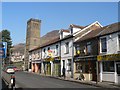
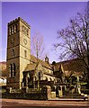
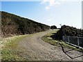
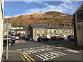
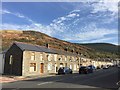
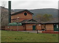
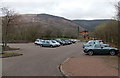
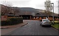
Photos of CF42 6EU


Area Information
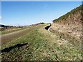
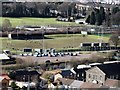
Living in CF42 6EU means inhabiting a small, densely populated residential cluster in the Rhondda Fawr valley of Wales. With a population of 1,450 and a density of 1,167 people per square kilometre, this area reflects a compact, tight-knit community. Historically a coal mining town, CF42 6EU evolved from scattered farmhouses into an industrial settlement by the late 19th century, shaped by the opening of collieries like Abergorki. While mining declined by the late 20th century, the area retained its cultural and social character, supported by institutions like the Treorchy Male Choir and Park and Dare Theatre. Today, CF42 6EU balances its industrial heritage with modern living, offering proximity to retail, rail networks, and community amenities. Its small size means residents share a distinct local identity, with a focus on community events and heritage. The area’s compact nature ensures that essential services are within practical reach, though its limited scale means buyers should consider nearby clusters for broader options.
- Area Type
- Postcode
- Area Size
- Not available
- Population
- 1450
- Population Density
- 1167 people/km²
The property market in CF42 6EU is characterised by a high rate of home ownership (74%) and a predominance of houses as the primary accommodation type. This suggests a market skewed towards owner-occupied properties rather than rentals, which may limit availability for renters seeking long-term housing. The compact size of the area means the housing stock is likely limited, with buyers needing to consider nearby postcode clusters for more options. The historical development as a mining town may influence property styles, with older homes forming a significant portion of the stock. For buyers, this could mean a mix of character properties and more modern builds, though the lack of detailed data on property ages or conditions means potential buyers should conduct local inspections. The small scale of the area also means that property prices may reflect broader regional trends in Rhondda Cynon Taf, influenced by factors like proximity to rail networks and retail amenities.
House Prices in CF42 6EU
No properties found in this postcode.
Energy Efficiency in CF42 6EU
The lifestyle in CF42 6EU is shaped by its proximity to retail and transport hubs. Within practical reach are five retail outlets, including Lidl Treorchy, Co-op Treorchy, and Iceland Treorchy, providing everyday shopping convenience. The area’s railway stations—Treorchy, Ton Pentre, and Ynyswen—offer access to broader networks, supporting both daily commutes and weekend travel. While the data does not specify parks or leisure facilities, the area’s historical role as a cultural centre suggests community events and venues like the Park and Dare Theatre contribute to local life. The compact nature of CF42 6EU means amenities are closely clustered, reducing travel time for errands and social activities. However, the lack of detailed information on green spaces or recreational areas leaves gaps in understanding the full lifestyle offering.
Amenities
Schools
The only named educational institution near CF42 6EU is the Treorchy Youth Centre, categorised as an "other" facility. No traditional schools are listed in the data, which may raise concerns for families prioritising formal education. The absence of schools in the immediate area suggests that residents must look beyond CF42 6EU for primary or secondary schooling, potentially increasing commuting times. While the area’s cultural institutions, such as the Park and Dare Theatre, contribute to community life, they do not replace the need for structured educational facilities. This lack of on-site schools contrasts with the area’s historical role as a social and commercial hub in the Rhondda. Buyers considering CF42 6EU should investigate nearby postcodes for school availability, as the current data does not provide a comprehensive picture of educational infrastructure.
| Rank | School | Type | Entry gender | Ages |
|---|
Explore more schools in this area
Go to Schools tabDemographics
CF42 6EU has a median age of 47, with the majority of residents aged between 30 and 64 years. This suggests a mature, stable population, likely with established careers and family ties. Home ownership is high at 74%, indicating a strong preference for long-term residency over rental properties. The accommodation type is predominantly houses, reflecting a more traditional housing stock compared to flats or apartments. The predominant ethnic group is White, though specific diversity metrics are not provided. The age profile and home ownership rates suggest a community that values stability and permanence. With a population density of 1,167 people per square kilometre, the area is neither sprawling nor sparse, fostering a sense of closeness. However, the lack of detailed data on deprivation or socioeconomic variation means the quality of life for lower-income residents remains unexplored in this context.
Household Size
Accommodation Type
Tenure
Ethnic Group
Religion
Household Composition
Age
Household Deprivation
NS-SEC
Explore more demographic insights in this area
Go to Demographics tabPlanning
Planning Constraints
- Flood RiskPremium
- Ramsar Wetland SitesPremium
- Area of Outstanding Natural BeautyPremium
- Protected Nature ReservePremium
- Protected WoodlandPremium
- Crime RiskPremium