Area Overview for CF42 5SB
Photos of CF42 5SB
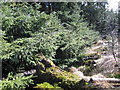
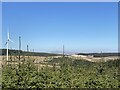
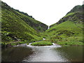
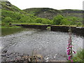
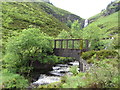
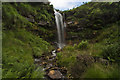
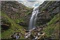
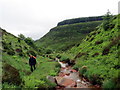
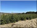
9 photos from this area
Area Information
Key information about the CF42 5SB including its size, population, and administrative classification.
- Area Type
- Postcode
- Area Size
- 9.8 km²
- Population
- 1484
- Population Density
- 109 people/km²
House Prices in CF42 5SB
36
Properties
£62,250
Average Sold Price
£15,000
Lowest Price
£144,500
Highest Price
Showing 36 properties
| Address | Type | Beds | Baths | Last Sale Price | Last Sale Date | |
|---|---|---|---|---|---|---|
| 47 Brook Street, Blaenrhondda, CF42 5SB | Detached | 4 | 1 | £125,000 | Mar 2025 | |
| 26 Brook Street, Blaenrhondda, CF42 5SB | Terraced | 3 | 1 | £144,500 | Apr 2024 | |
| 44 Brook Street, Blaenrhondda, CF42 5SB | house | 3 | 1 | £94,995 | Jul 2021 | |
| 38 Brook Street, Blaenrhondda, CF42 5SB | Terraced | 3 | 1 | £60,000 | Aug 2019 | |
| 32 Brook Street, Blaenrhondda, CF42 5SB | house | - | - | £75,000 | Sep 2018 | |
| 34 Brook Street, Blaenrhondda, CF42 5SB | Semi-detached | 3 | 1 | £70,000 | Sep 2018 | |
| 22 Brook Street, Blaenrhondda, CF42 5SB | house | - | - | £56,000 | Mar 2018 | |
| 27 Brook Street, Blaenrhondda, CF42 5SB | Terraced | 2 | 1 | £57,500 | Oct 2016 | |
| 24 Brook Street, Blaenrhondda, CF42 5SB | house | 2 | 1 | £45,000 | Oct 2015 | |
| 20 Brook Street, Blaenrhondda, CF42 5SB | house | 3 | - | £67,000 | Jun 2015 |
Page 1 of 4
Energy Efficiency in CF42 5SB
Amenities
Schools
| Rank | School | Type | Entry gender | Ages |
|---|
Explore more schools in this area
Go to Schools tabDemographics
Household Size
One person
most common
Accommodation Type
Houses
most common
Tenure
67
majority
Ethnic Group
White
most common
Religion
N/A
most common
Household Composition
N/A
most common
Age
47
median
Adults (30-64 years)
most common
Household Deprivation
N/A
with no deprivation
NS-SEC
19
in Lower managerial occupations
Explore more demographic insights in this area
Go to Demographics tabPlanning
Planning Constraints
- Flood RiskPremium
- Ramsar Wetland SitesPremium
- Area of Outstanding Natural BeautyPremium
- Protected Nature ReservePremium
- Protected WoodlandPremium
- Crime RiskPremium