Area Overview for CF41 7RW
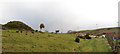
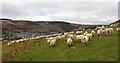
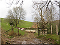
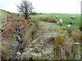
Photos of CF41 7RW
Area Information
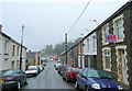
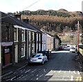
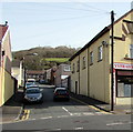
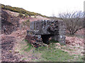
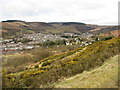
Living in CF41 7RW means residing in a specific residential cluster within the historic village of Ystrad in the Rhondda Fawr valley. The postcode covers a compact footprint of 2,922 square metres, accommodating a population of 1,363 people. This setting offers a self-contained community feel typical of former coal-mining villages in the South Wales Coalfield. Ystrad derives its name from the historic parish of Ystradyfodwg, referencing low-lying meadowland near the river Ynys Fach. You are positioned in a rural crossroads where ancient paths historically met, close to sites like the 17th-century water mill Melyn Yr Om. The area retains a strong local identity dating back to its first mention in early records as Ynys Fach. Today, the environment remains defined by this industrial heritage, with noted features including St. Stephen's Church from 1896 and the historic Oddfellows Row. The location provides a quiet, distinct lifestyle removed from major urban centres yet connected by local infrastructure. You can expect a stable residential environment where daily life revolves around the immediate neighbourhood and the broader Rhondda community. The small area size ensures a contained social dynamic, perfect for those seeking a slice of authentic Welsh valley living.
- Area Type
- Postcode
- Area Size
- 2922 m²
- Population
- Not available
- Population Density
- Not available
The property market in CF41 7RW is characterised by a stock heavily weighted towards house ownership. With 72% of households in the postcode being owner-occupied, the area functions primarily as a residence for those who have purchased their homes. Houses dominate the accommodation types available, meaning you will rarely encounter high-rise apartments or converted flats in this specific cluster. This structure is typical for Ystrad, a long, narrow village where land use prioritises single-family homes. Buyers looking for detached or semi-detached properties will find an environment suited to their needs. The low density of 466,519 people per square kilometre within the 2,922 square metre area confirms a lack of high-density housing blocks. Investment opportunities here align with buying a home to live in rather than rapid rental turnover. The market reflects the stable nature of the local community where people settle permanently. If you are considering homes in CF41 7RW, you are entering a market defined by permanence and brick-and-mortar ownership rather than the fluctuating rental sectors found in larger cities.
House Prices in CF41 7RW
Showing 16 properties
| Address | Type | Beds | Baths | Last Sale Price | Last Sale Date | |
|---|---|---|---|---|---|---|
| 13 Chapel Street, Ystrad, Pentre, CF41 7RW | Terraced | 4 | 1 | £184,000 | Dec 2025 | |
| 2 Chapel Street, Ystrad, Pentre, CF41 7RW | Terraced | 3 | 1 | £110,000 | Mar 2023 | |
| 10 Chapel Street, Ystrad, Pentre, CF41 7RW | house | - | - | £55,000 | May 2021 | |
| 9 Chapel Street, Ystrad, Pentre, CF41 7RW | Terraced | 3 | - | £72,000 | Oct 2015 | |
| 14 Chapel Street, Ystrad, Pentre, CF41 7RW | Terraced | 3 | - | £57,000 | Jul 2014 | |
| 7 Chapel Street, Ystrad, Pentre, CF41 7RW | Terraced | 3 | 1 | £75,000 | Aug 2011 | |
| 8 Chapel Street, Ystrad, Pentre, CF41 7RW | house | - | - | £51,000 | Oct 2010 | |
| 6 Chapel Street, Ystrad, Pentre, CF41 7RW | Terraced | - | - | £60,000 | Nov 2008 | |
| 12 Chapel Street, Ystrad, Pentre, CF41 7RW | Terraced | - | - | £38,000 | Apr 2004 | |
| 11 Chapel Street, Ystrad, Pentre, CF41 7RW | Terraced | - | - | £43,000 | Apr 2002 |
Energy Efficiency in CF41 7RW
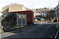
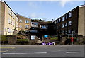
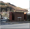
Daily life in CF41 7RW benefits from a practical network of amenities within practical reach. Residents have access to five railway stations, including Ystrad Rhondda Railway Station, Llwynypia Railway Station, and Ton Pentre Railway Station, facilitating easy travel outside the valley. Shopping convenience is provided by five retail locations, notably Asda Tonypandy, Spar, and Co-op Ferndale, which cover everyday grocery and household needs. You do not need to travel far for basic necessities or train connections. The historic Gellidawel Inn serves as a notable local meeting point, while the area's character is shaped by its proximity to the Rhondda Line transport route. These facilities integrate seamlessly into the traditional village rhythm without overwhelming the quiet atmosphere. The combination of local supermarkets and rail access creates a balanced lifestyle where you have modern amenities without sacrificing countryside calm.
Amenities
Schools
Families in CF41 7RW have access to two key educational facilities within the immediate vicinity. The area is served by Ysgol G.G. Bodringallt and Ysgol Hen Felin, both listed as schools near this postcode. Data identifies these institutions by name without specifying their exact age group focus or current Ofsted ratings in the provided information. The presence of two "other" type schools suggests a mix of educational provision potentially catering to specific community needs or older students. While specific exam results or league table rankings are not included in the current dataset, the names confirm that established local schooling is available. You do not need to travel far for education, as both Ystrad facilities are located in pockets practical for daily commutes. This setup supports families who prefer their children to attend schools with local ties rather than travelling to urban centres. The schools represent permanent fixtures in the community landscape.
| Rank | School | Type | Entry gender | Ages |
|---|
Explore more schools in this area
Go to Schools tabDemographics
The community in CF41 7RW reflects a mature population with a median age of 47 years. Most residents fall within the adult age range of 30 to 64 years, indicating a stable workforce and established families rather than transient populations. Home ownership stands at 72%, which signals a neighbourhood dominated by long-term residents rather than tenants. Houses comprise the primary form of accommodation, aligning with the area's historical development as a village centre. The predominant ethnic group is White, consistent with the region's demographic history. This high rate of ownership suggests that many inhabitants have built their lives here over significant periods. The age profile implies a calm atmosphere where life may centre around retirement or mid-career stages rather than young dependent families. There are no areas of high deprivation noted in the available data for this postcode. The community structure supports a traditional model of settlement where neighbours know one another well. With such a high percentage of owner-occupiers, street accountability and social cohesion are likely high. You will find a area where roots run deep and change in the population is gradual.
Household Size
Accommodation Type
Tenure
Ethnic Group
Religion
Household Composition
Age
Household Deprivation
NS-SEC
Explore more demographic insights in this area
Go to Demographics tabPlanning
Planning Constraints
- Flood RiskPremium
- Ramsar Wetland SitesPremium
- Area of Outstanding Natural BeautyPremium
- Protected Nature ReservePremium
- Protected WoodlandPremium
- Crime RiskPremium