Area Overview for CF41 7NE
Photos of CF41 7NE
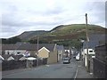
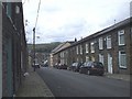
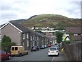
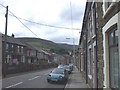
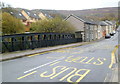
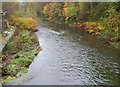
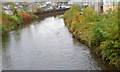
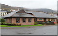
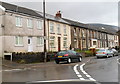
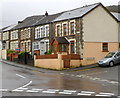
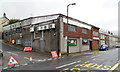
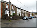
31 photos from this area
Area Information
Key information about the CF41 7NE including its size, population, and administrative classification.
- Area Type
- Postcode
- Area Size
- 7524 m²
- Population
- 1476
- Population Density
- 7756 people/km²
House Prices in CF41 7NE
28
Properties
£64,532
Average Sold Price
£23,000
Lowest Price
£122,000
Highest Price
Showing 28 properties
| Address | Type | Beds | Baths | Last Sale Price | Last Sale Date | |
|---|---|---|---|---|---|---|
| 1 Rees Street, Gelli, Pentre, CF41 7NE | Terraced | 3 | 1 | £93,000 | Feb 2024 | |
| 63 Rees Street, Gelli, Pentre, CF41 7NE | house | - | - | £82,500 | Oct 2020 | |
| 13 Rees Street, Gelli, Pentre, CF41 7NE | Terraced | 4 | 1 | £100,000 | Sep 2018 | |
| 61 Rees Street, Gelli, Pentre, CF41 7NE | Terraced | 3 | 1 | £122,000 | Sep 2018 | |
| 58 Rees Street, Gelli, Pentre, CF41 7NE | house | - | - | £105,000 | Feb 2011 | |
| 65 Rees Street, Gelli, Pentre, CF41 7NE | house | - | - | £85,500 | Dec 2010 | |
| 64 Rees Street, Gelli, Pentre, CF41 7NE | house | 3 | - | £61,000 | Feb 2010 | |
| 69 Rees Street, Gelli, Pentre, CF41 7NE | house | - | - | £63,000 | Sep 2005 | |
| 62 Rees Street, Gelli, Pentre, CF41 7NE | Terraced | - | - | £49,950 | Feb 2005 | |
| 6 Rees Street, Gelli, Pentre, CF41 7NE | house | - | - | £26,000 | Nov 2003 |
Page 1 of 3
Energy Efficiency in CF41 7NE
Amenities
Schools
| Rank | School | Type | Entry gender | Ages |
|---|
Explore more schools in this area
Go to Schools tabDemographics
Household Size
Family (3-5 people)
most common
Accommodation Type
Houses
most common
Tenure
74
majority
Ethnic Group
White
most common
Religion
N/A
most common
Household Composition
N/A
most common
Age
47
median
Adults (30-64 years)
most common
Household Deprivation
N/A
with no deprivation
NS-SEC
20
in Lower managerial occupations
Explore more demographic insights in this area
Go to Demographics tabPlanning
Planning Constraints
- Flood RiskPremium
- Ramsar Wetland SitesPremium
- Area of Outstanding Natural BeautyPremium
- Protected Nature ReservePremium
- Protected WoodlandPremium
- Crime RiskPremium