Area Overview for CF39 9TL
Photos of CF39 9TL
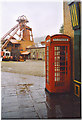
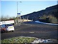
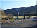
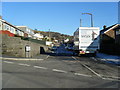
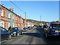
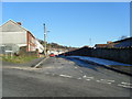
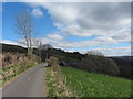
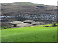
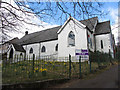


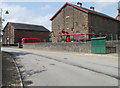
40 photos from this area
Area Information
Key information about the CF39 9TL including its size, population, and administrative classification.
- Area Type
- Postcode
- Area Size
- 1.3 hectares
- Population
- 1433
- Population Density
- 2233 people/km²
House Prices in CF39 9TL
20
Properties
£147,900
Average Sold Price
£55,000
Lowest Price
£250,000
Highest Price
Showing 20 properties
| Address | Type | Beds | Baths | Last Sale Price | Last Sale Date | |
|---|---|---|---|---|---|---|
| 10 Heather Way, Porth, CF39 9TL | Semi-detached | 3 | 1 | £140,000 | Sep 2023 | |
| 15 Heather Way, Porth, CF39 9TL | Semi-detached | 2 | 1 | £190,000 | Jun 2023 | |
| 18 Heather Way, Porth, CF39 9TL | Bungalow | 2 | 1 | £215,000 | Dec 2022 | |
| 16 Heather Way, Porth, CF39 9TL | Retail | 3 | 1 | £250,000 | Nov 2022 | |
| 8 Heather Way, Porth, CF39 9TL | Semi-detached | 3 | 1 | £150,000 | Feb 2020 | |
| 11 Heather Way, Porth, CF39 9TL | house | - | - | £135,000 | Feb 2018 | |
| 19 Heather Way, Porth, CF39 9TL | Bungalow | 2 | - | £150,000 | Apr 2015 | |
| 3 Heather Way, Porth, CF39 9TL | house | - | - | £108,000 | Nov 2013 | |
| 12 Heather Way, Porth, CF39 9TL | Semi-detached | 3 | - | £86,000 | Sep 2012 | |
| 9 Heather Way, Porth, CF39 9TL | Semi-detached | - | - | £55,000 | Jun 2000 |
Page 1 of 2
Energy Efficiency in CF39 9TL
Amenities
Schools
| Rank | School | Type | Entry gender | Ages |
|---|
Explore more schools in this area
Go to Schools tabDemographics
Household Size
One person
most common
Accommodation Type
Houses
most common
Tenure
60
majority
Ethnic Group
White
most common
Religion
N/A
most common
Household Composition
N/A
most common
Age
47
median
Adults (30-64 years)
most common
Household Deprivation
N/A
with no deprivation
NS-SEC
20
in Lower managerial occupations
Explore more demographic insights in this area
Go to Demographics tabPlanning
Planning Constraints
- Flood RiskPremium
- Ramsar Wetland SitesPremium
- Area of Outstanding Natural BeautyPremium
- Protected Nature ReservePremium
- Protected WoodlandPremium
- Crime RiskPremium