Area Overview for CF39 9PG
Photos of CF39 9PG
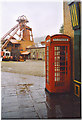
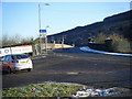
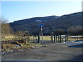
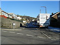
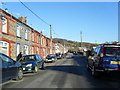
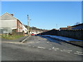

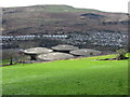
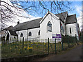


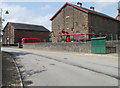
40 photos from this area
Area Information
Key information about the CF39 9PG including its size, population, and administrative classification.
- Area Type
- Postcode
- Area Size
- 3.8 hectares
- Population
- 1285
- Population Density
- 479 people/km²
House Prices in CF39 9PG
39
Properties
£41,832
Average Sold Price
£25,500
Lowest Price
£64,995
Highest Price
Showing 39 properties
| Address | Type | Beds | Baths | Last Sale Price | Last Sale Date | |
|---|---|---|---|---|---|---|
| 61 Pontypridd Road, Porth, CF39 9PG | house | 3 | 1 | £64,995 | Dec 2022 | |
| 62 Pontypridd Road, Porth, CF39 9PG | house | - | - | £35,000 | Jan 2016 | |
| 57 Pontypridd Road, Porth, CF39 9PG | Terraced | - | - | £25,500 | Nov 2002 | |
| 52A Pontypridd Road, Porth, CF39 9PG | Terraced | 3 | 1 | - | - | |
| 1, Britannia Place, Eirw Road, Porth, CF39 9PG | Flat | - | - | - | - | |
| 2, Britannia Place, Eirw Road, Porth, CF39 9PG | Flat | - | - | - | - | |
| 46 Pontypridd Road, Porth, CF39 9PG | Terraced | - | - | - | - | |
| 50A Pontypridd Road, Porth, CF39 9PG | Flat | - | - | - | - | |
| Car Sales, Pontypridd Road, Porth, CF39 9PG | warehouse | - | - | - | - | |
| Filling Station, Pontypridd Road, Porth, CF39 9PG | Retail | - | - | - | - |
Page 1 of 4
Energy Efficiency in CF39 9PG
Amenities
Schools
| Rank | School | Type | Entry gender | Ages |
|---|
Explore more schools in this area
Go to Schools tabDemographics
Household Size
One person
most common
Accommodation Type
Houses
most common
Tenure
74
majority
Ethnic Group
White
most common
Religion
N/A
most common
Household Composition
N/A
most common
Age
47
median
Adults (30-64 years)
most common
Household Deprivation
N/A
with no deprivation
NS-SEC
24
in Lower managerial occupations
Explore more demographic insights in this area
Go to Demographics tabPlanning
Planning Constraints
- Flood RiskPremium
- Ramsar Wetland SitesPremium
- Area of Outstanding Natural BeautyPremium
- Protected Nature ReservePremium
- Protected WoodlandPremium
- Crime RiskPremium