Area Overview for CF39 8PB
Photos of CF39 8PB
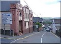

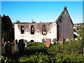
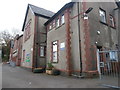

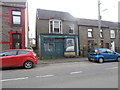
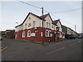
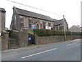
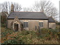
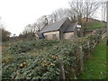
56 photos from this area
Area Information
Key information about the CF39 8PB including its size, population, and administrative classification.
- Area Type
- Postcode
- Area Size
- 9164 m²
- Population
- 1452
- Population Density
- 3378 people/km²
House Prices in CF39 8PB
45
Properties
£91,830
Average Sold Price
£23,000
Lowest Price
£172,000
Highest Price
Showing 45 properties
| Address | Type | Beds | Baths | Last Sale Price | Last Sale Date | |
|---|---|---|---|---|---|---|
| 47 Prichard Street, Tonyrefail, CF39 8PB | Terraced | 4 | 1 | £149,950 | May 2025 | |
| 7 Prichard Street, Tonyrefail, CF39 8PB | Terraced | 3 | 1 | £172,000 | Jun 2024 | |
| 71 Prichard Street, Tonyrefail, CF39 8PB | Terraced | 3 | 1 | £160,000 | Oct 2023 | |
| 11 Prichard Street, Tonyrefail, CF39 8PB | house | - | - | £90,000 | Mar 2023 | |
| 13 Prichard Street, Tonyrefail, CF39 8PB | Retail | 3 | 1 | £164,000 | Mar 2022 | |
| 85 Prichard Street, Tonyrefail, CF39 8PB | house | - | - | £99,950 | Oct 2021 | |
| 77 Prichard Street, Tonyrefail, CF39 8PB | Terraced | 3 | - | £125,000 | Feb 2021 | |
| 59 Prichard Street, Tonyrefail, CF39 8PB | Terraced | 3 | 1 | £139,000 | Jan 2020 | |
| 27 Prichard Street, Tonyrefail, CF39 8PB | house | - | - | £95,000 | Dec 2019 | |
| 53 Prichard Street, Tonyrefail, CF39 8PB | Terraced | 3 | 1 | £100,000 | May 2019 |
Page 1 of 5
Energy Efficiency in CF39 8PB
Amenities
Schools
| Rank | School | Type | Entry gender | Ages |
|---|
Explore more schools in this area
Go to Schools tabDemographics
Household Size
One person
most common
Accommodation Type
Houses
most common
Tenure
68
majority
Ethnic Group
White
most common
Religion
N/A
most common
Household Composition
N/A
most common
Age
47
median
Adults (30-64 years)
most common
Household Deprivation
N/A
with no deprivation
NS-SEC
19
in Lower managerial occupations
Explore more demographic insights in this area
Go to Demographics tabPlanning
Planning Constraints
- Flood RiskPremium
- Ramsar Wetland SitesPremium
- Area of Outstanding Natural BeautyPremium
- Protected Nature ReservePremium
- Protected WoodlandPremium
- Crime RiskPremium