Area Overview for CF39 0LZ
Photos of CF39 0LZ
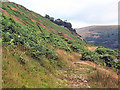
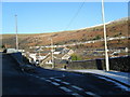
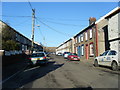
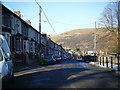

50 photos from this area
Area Information
Key information about the CF39 0LZ including its size, population, and administrative classification.
- Area Type
- Postcode
- Area Size
- 9.5 hectares
- Population
- 1543
- Population Density
- 2678 people/km²
House Prices in CF39 0LZ
54
Properties
£153,687
Average Sold Price
£31,000
Lowest Price
£325,000
Highest Price
Showing 54 properties
| Address | Type | Beds | Baths | Last Sale Price | Last Sale Date | |
|---|---|---|---|---|---|---|
| 37 Pleasant Heights, Porth, CF39 0LZ | Retail | 4 | 2 | £325,000 | Mar 2022 | |
| 24 Pleasant Heights, Porth, CF39 0LZ | Land | 4 | - | £310,000 | Oct 2021 | |
| 18 Pleasant Heights, Porth, CF39 0LZ | Detached | 4 | 1 | £216,500 | Jun 2021 | |
| 38 Pleasant Heights, Porth, CF39 0LZ | house | - | - | £80,000 | Aug 2019 | |
| 31 Pleasant Heights, Porth, CF39 0LZ | house | - | - | £257,000 | Aug 2019 | |
| 36 Pleasant Heights, Porth, CF39 0LZ | house | - | - | £250,000 | Jul 2018 | |
| 34 Pleasant Heights, Porth, CF39 0LZ | house | - | - | £249,995 | May 2018 | |
| 33 Pleasant Heights, Porth, CF39 0LZ | house | - | - | £249,995 | Mar 2018 | |
| 35 Pleasant Heights, Porth, CF39 0LZ | house | - | - | £110,000 | Dec 2017 | |
| 30 Pleasant Heights, Porth, CF39 0LZ | Detached | 3 | 2 | £199,995 | May 2017 |
Page 1 of 6
Energy Efficiency in CF39 0LZ
Amenities
Schools
| Rank | School | Type | Entry gender | Ages |
|---|
Explore more schools in this area
Go to Schools tabDemographics
Household Size
Family (3-5 people)
most common
Accommodation Type
Houses
most common
Tenure
89
majority
Ethnic Group
White
most common
Religion
N/A
most common
Household Composition
N/A
most common
Age
47
median
Adults (30-64 years)
most common
Household Deprivation
N/A
with no deprivation
NS-SEC
29
in Lower managerial occupations
Explore more demographic insights in this area
Go to Demographics tabPlanning
Planning Constraints
- Flood RiskPremium
- Ramsar Wetland SitesPremium
- Area of Outstanding Natural BeautyPremium
- Protected Nature ReservePremium
- Protected WoodlandPremium
- Crime RiskPremium