Area Overview for CF38 2SJ
Photos of CF38 2SJ
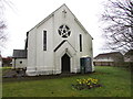
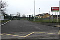
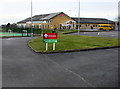
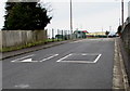
20 photos from this area
Area Information
Key information about the CF38 2SJ including its size, population, and administrative classification.
- Area Type
- Postcode
- Area Size
- 1.4 hectares
- Population
- 1574
- Population Density
- 1981 people/km²
House Prices in CF38 2SJ
31
Properties
£162,860
Average Sold Price
£77,000
Lowest Price
£325,000
Highest Price
Showing 31 properties
| Address | Type | Beds | Baths | Last Sale Price | Last Sale Date | |
|---|---|---|---|---|---|---|
| 30 Willow Close, Beddau, CF38 2SJ | Detached | 4 | 2 | £325,000 | Apr 2024 | |
| 24 Willow Close, Beddau, CF38 2SJ | Detached | 3 | 2 | £312,500 | Dec 2023 | |
| 21 Willow Close, Beddau, CF38 2SJ | Detached | 4 | 2 | £255,000 | Jun 2021 | |
| 17 Willow Close, Beddau, CF38 2SJ | house | - | - | £272,950 | Nov 2019 | |
| 16 Willow Close, Beddau, CF38 2SJ | Detached | 4 | - | £245,000 | Sep 2019 | |
| 11 Willow Close, Beddau, CF38 2SJ | Detached | 4 | 2 | £214,000 | Aug 2017 | |
| 15 Willow Close, Beddau, CF38 2SJ | house | - | - | £207,500 | Sep 2016 | |
| 8 Willow Close, Beddau, CF38 2SJ | Detached | 4 | 2 | £213,000 | Jun 2015 | |
| 2 Willow Close, Beddau, CF38 2SJ | Detached | 4 | 2 | £212,000 | Jan 2015 | |
| 7 Willow Close, Beddau, CF38 2SJ | Detached | 3 | - | £183,000 | Apr 2013 |
Page 1 of 4
Energy Efficiency in CF38 2SJ
Amenities
Schools
| Rank | School | Type | Entry gender | Ages |
|---|
Explore more schools in this area
Go to Schools tabDemographics
Household Size
Family (3-5 people)
most common
Accommodation Type
Houses
most common
Tenure
81
majority
Ethnic Group
White
most common
Religion
N/A
most common
Household Composition
N/A
most common
Age
47
median
Adults (30-64 years)
most common
Household Deprivation
N/A
with no deprivation
NS-SEC
43
in Lower managerial occupations
Explore more demographic insights in this area
Go to Demographics tabPlanning
Planning Constraints
- Flood RiskPremium
- Ramsar Wetland SitesPremium
- Area of Outstanding Natural BeautyPremium
- Protected Nature ReservePremium
- Protected WoodlandPremium
- Crime RiskPremium