Area Overview for CF38 2FH
Photos of CF38 2FH
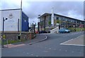


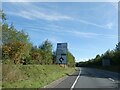

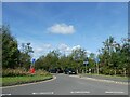


9 photos from this area
Area Information
Key information about the CF38 2FH including its size, population, and administrative classification.
- Area Type
- Postcode
- Area Size
- 7.5 hectares
- Population
- 1438
- Population Density
- 1646 people/km²
House Prices in CF38 2FH
89
Properties
£330,099
Average Sold Price
£239,995
Lowest Price
£482,995
Highest Price
Showing 89 properties
| Address | Type | Beds | Baths | Last Sale Price | Last Sale Date | |
|---|---|---|---|---|---|---|
| 9 Ffordd Y Friallen, Llantwit Fardre, CF38 2FH | Semi-detached | 3 | 2 | £265,000 | Jun 2025 | |
| 41 Ffordd Y Friallen, Llantwit Fardre, CF38 2FH | house | - | - | £444,995 | Feb 2025 | |
| 48 Ffordd Y Friallen, Llantwit Fardre, CF38 2FH | house | - | - | £244,995 | Jan 2025 | |
| 52 Ffordd Y Friallen, Llantwit Fardre, CF38 2FH | house | - | - | £239,995 | Jan 2025 | |
| 49 Ffordd Y Friallen, Llantwit Fardre, CF38 2FH | house | - | - | £239,995 | Jan 2025 | |
| 50 Ffordd Y Friallen, Llantwit Fardre, CF38 2FH | house | - | - | £274,995 | Jan 2025 | |
| 53 Ffordd Y Friallen, Llantwit Fardre, CF38 2FH | house | - | - | £319,995 | Jan 2025 | |
| 39 Ffordd Y Friallen, Llantwit Fardre, CF38 2FH | house | - | - | £445,995 | Dec 2024 | |
| 76 Ffordd Y Friallen, Llantwit Fardre, CF38 2FH | house | - | - | £375,000 | Dec 2024 | |
| 81 Ffordd Y Friallen, Llantwit Fardre, CF38 2FH | house | - | - | £335,000 | Aug 2024 |
Page 1 of 9
Energy Efficiency in CF38 2FH
Amenities
Schools
| Rank | School | Type | Entry gender | Ages |
|---|
Explore more schools in this area
Go to Schools tabDemographics
Household Size
Two person
most common
Accommodation Type
Houses
most common
Tenure
83
majority
Ethnic Group
White
most common
Religion
N/A
most common
Household Composition
N/A
most common
Age
47
median
Adults (30-64 years)
most common
Household Deprivation
N/A
with no deprivation
NS-SEC
45
in Lower managerial occupations
Explore more demographic insights in this area
Go to Demographics tabPlanning
Planning Constraints
- Flood RiskPremium
- Ramsar Wetland SitesPremium
- Area of Outstanding Natural BeautyPremium
- Protected Nature ReservePremium
- Protected WoodlandPremium
- Crime RiskPremium