Area Overview for CF38 2FA
Photos of CF38 2FA
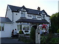
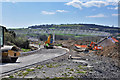
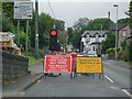
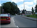
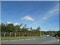
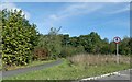
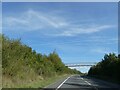
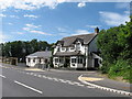
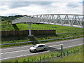
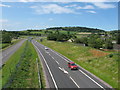
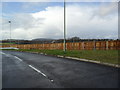
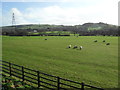
15 photos from this area
Area Information
Key information about the CF38 2FA including its size, population, and administrative classification.
- Area Type
- Postcode
- Area Size
- 5.1 hectares
- Population
- 1658
- Population Density
- 506 people/km²
House Prices in CF38 2FA
89
Properties
£236,274
Average Sold Price
£99,995
Lowest Price
£437,500
Highest Price
Showing 89 properties
| Address | Type | Beds | Baths | Last Sale Price | Last Sale Date | |
|---|---|---|---|---|---|---|
| 47 Cadwal Court, Llantwit Fardre, CF38 2FA | Terraced | 2 | 1 | £210,000 | Sep 2025 | |
| 20 Cadwal Court, Llantwit Fardre, CF38 2FA | Detached | 4 | 2 | £399,950 | Jul 2025 | |
| 25 Cadwal Court, Llantwit Fardre, CF38 2FA | Detached | 4 | 2 | £437,500 | Feb 2025 | |
| 35 Cadwal Court, Llantwit Fardre, CF38 2FA | house | - | - | £255,000 | Jan 2024 | |
| 57 Cadwal Court, Llantwit Fardre, CF38 2FA | Detached | 4 | 2 | £375,000 | May 2023 | |
| 43 Cadwal Court, Llantwit Fardre, CF38 2FA | Semi-detached | 3 | 2 | £245,000 | Dec 2022 | |
| 12 Cadwal Court, Llantwit Fardre, CF38 2FA | Detached | 4 | 1 | £364,000 | Aug 2022 | |
| 44 Cadwal Court, Llantwit Fardre, CF38 2FA | Terraced | 2 | 1 | £195,000 | Jun 2022 | |
| 51 Cadwal Court, Llantwit Fardre, CF38 2FA | house | 3 | 2 | £250,000 | Mar 2022 | |
| 32 Cadwal Court, Llantwit Fardre, CF38 2FA | Detached | 3 | 2 | £256,000 | Jun 2021 |
Page 1 of 9
Energy Efficiency in CF38 2FA
Amenities
Schools
| Rank | School | Type | Entry gender | Ages |
|---|
Explore more schools in this area
Go to Schools tabDemographics
Household Size
Two person
most common
Accommodation Type
Houses
most common
Tenure
86
majority
Ethnic Group
White
most common
Religion
N/A
most common
Household Composition
N/A
most common
Age
47
median
Adults (30-64 years)
most common
Household Deprivation
N/A
with no deprivation
NS-SEC
34
in Lower managerial occupations
Explore more demographic insights in this area
Go to Demographics tabPlanning
Planning Constraints
- Flood RiskPremium
- Ramsar Wetland SitesPremium
- Area of Outstanding Natural BeautyPremium
- Protected Nature ReservePremium
- Protected WoodlandPremium
- Crime RiskPremium