Area Overview for CF38 1PY
Photos of CF38 1PY
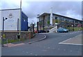

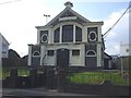
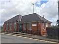
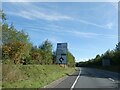

9 photos from this area
Area Information
Key information about the CF38 1PY including its size, population, and administrative classification.
- Area Type
- Postcode
- Area Size
- 1.5 hectares
- Population
- 2545
- Population Density
- 3129 people/km²
House Prices in CF38 1PY
17
Properties
£174,917
Average Sold Price
£49,750
Lowest Price
£300,000
Highest Price
Showing 17 properties
| Address | Type | Beds | Baths | Last Sale Price | Last Sale Date | |
|---|---|---|---|---|---|---|
| Brook House, Main Road, Church Village, CF38 1PY | house | 4 | 1 | £300,000 | Jan 2022 | |
| Brynawel, Main Road, Church Village, CF38 1PY | Semi-detached | 3 | 2 | £175,000 | Oct 2019 | |
| Brynhyfryd, Main Road, Church Village, CF38 1PY | Semi-detached | - | - | £49,750 | Oct 2000 | |
| Rosedene, Main Road, Church Village, CF38 1PY | Flat | - | - | - | - | |
| Treetops, Main Road, Church Village, CF38 1PY | Maisonette | - | - | - | - | |
| Tattoo, 3 Main Road, Church Village, CF38 1PY | shop | - | - | - | - | |
| Flat Above 5, Main Road, Church Village, CF38 1PY | Flat | - | - | - | - | |
| Flat At The Village Arms, Main Road, Church Village, CF38 1PY | Flat | - | - | - | - | |
| Flat C, Allied Healthcare Group, Main Road, Church Village, CF38 1PY | house | - | - | - | - | |
| Flat 5B, Allied Healthcare Group, Main Road, Church Village, CF38 1PY | Flat | - | - | - | - |
Page 1 of 2
Energy Efficiency in CF38 1PY
Amenities
Schools
| Rank | School | Type | Entry gender | Ages |
|---|
Explore more schools in this area
Go to Schools tabDemographics
Household Size
Family (3-5 people)
most common
Accommodation Type
Houses
most common
Tenure
64
majority
Ethnic Group
White
most common
Religion
N/A
most common
Household Composition
N/A
most common
Age
47
median
Adults (30-64 years)
most common
Household Deprivation
N/A
with no deprivation
NS-SEC
32
in Lower managerial occupations
Explore more demographic insights in this area
Go to Demographics tabPlanning
Planning Constraints
- Flood RiskPremium
- Ramsar Wetland SitesPremium
- Area of Outstanding Natural BeautyPremium
- Protected Nature ReservePremium
- Protected WoodlandPremium
- Crime RiskPremium