Area Overview for CF37 5LN
Photos of CF37 5LN

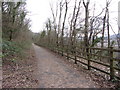


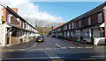
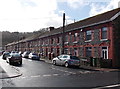


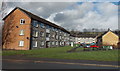
44 photos from this area
Area Information
Key information about the CF37 5LN including its size, population, and administrative classification.
- Area Type
- Postcode
- Area Size
- 3.3 hectares
- Population
- Not available
- Population Density
- Not available
House Prices in CF37 5LN
16
Properties
£167,000
Average Sold Price
£59,999
Lowest Price
£246,000
Highest Price
Showing 16 properties
| Address | Type | Beds | Baths | Last Sale Price | Last Sale Date | |
|---|---|---|---|---|---|---|
| 10 Fairfield Lane, Hawthorn, Pontypridd, CF37 5LN | Flat | - | - | £115,000 | Apr 2025 | |
| 2 Fairfield Lane, Hawthorn, Pontypridd, CF37 5LN | house | - | - | £236,000 | Mar 2021 | |
| 6 Fairfield Lane, Hawthorn, Pontypridd, CF37 5LN | Semi-detached | 4 | 1 | £246,000 | Aug 2020 | |
| 3 Fairfield Lane, Hawthorn, Pontypridd, CF37 5LN | Semi-detached | - | - | £240,000 | Jul 2019 | |
| 9 Fairfield Lane, Hawthorn, Pontypridd, CF37 5LN | Flat | - | - | £59,999 | Jun 2005 | |
| 1 Fairfield Lane, Hawthorn, Pontypridd, CF37 5LN | Semi-detached | - | - | £200,000 | Jun 2005 | |
| 4 Fairfield Lane, Hawthorn, Pontypridd, CF37 5LN | Semi-detached | - | - | £72,000 | Aug 1997 | |
| Ty Ni, Fairfield Lane, Hawthorn, Pontypridd, CF37 5LN | house | - | - | - | - | |
| Hawthorn Community Centre, Fairfield Lane, Hawthorn, Pontypridd, CF37 5LN | Office | - | - | - | - | |
| 5 Fairfield Lane, Hawthorn, Pontypridd, CF37 5LN | Semi-detached | - | - | - | - |
Page 1 of 2
Energy Efficiency in CF37 5LN
Amenities
Schools
| Rank | School | Type | Entry gender | Ages |
|---|
Explore more schools in this area
Go to Schools tabDemographics
Household Size
One person
most common
Accommodation Type
Houses
most common
Tenure
57
majority
Ethnic Group
White
most common
Religion
N/A
most common
Household Composition
N/A
most common
Age
47
median
Adults (30-64 years)
most common
Household Deprivation
N/A
with no deprivation
NS-SEC
24
in Lower managerial occupations
Explore more demographic insights in this area
Go to Demographics tabPlanning
Planning Constraints
- Flood RiskPremium
- Ramsar Wetland SitesPremium
- Area of Outstanding Natural BeautyPremium
- Protected Nature ReservePremium
- Protected WoodlandPremium
- Crime RiskPremium