Area Overview for CF37 5AL
Photos of CF37 5AL
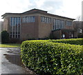
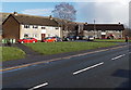

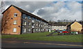
44 photos from this area
Area Information
Key information about the CF37 5AL including its size, population, and administrative classification.
- Area Type
- Postcode
- Area Size
- 7.2 hectares
- Population
- 2098
- Population Density
- 512 people/km²
House Prices in CF37 5AL
9
Properties
£173,988
Average Sold Price
£87,000
Lowest Price
£249,950
Highest Price
Showing 9 properties
| Address | Type | Beds | Baths | Last Sale Price | Last Sale Date | |
|---|---|---|---|---|---|---|
| Garth, 2 School Lane, Rhydyfelin, Pontypridd, CF37 5AL | house | - | - | £249,950 | Oct 2021 | |
| Tre Mabe, School Lane, Rhydyfelin, Pontypridd, CF37 5AL | Bungalow | - | - | £87,000 | Jul 2019 | |
| Homeleigh, 3 School Lane, Rhydyfelin, Pontypridd, CF37 5AL | Semi-detached | 3 | 1 | £185,000 | Nov 2018 | |
| Gwynfa, 1 School Lane, Rhydyfelin, Pontypridd, CF37 5AL | house | - | - | £174,000 | Aug 2017 | |
| Oakdale, 4 School Lane, Rhydyfelin, Pontypridd, CF37 5AL | Detached | 2 | 1 | - | - | |
| Pitch 3G, School Lane, Rhydyfelin, Pontypridd, CF37 5AL | Leisure | - | - | - | - | |
| Pitch 3G, Ysgol Afon Wen, School Lane, Rhydyfelin, Pontypridd, CF37 5AL | Leisure | - | - | - | - | |
| Hawthorn Swimming Pool, School Lane, Rhydyfelin, Pontypridd, CF37 5AL | education | - | - | - | - | |
| School House, School Lane, Rhydyfelin, Pontypridd, CF37 5AL | office_workshop | - | - | - | - |
Energy Efficiency in CF37 5AL
Amenities
Schools
| Rank | School | Type | Entry gender | Ages |
|---|
Explore more schools in this area
Go to Schools tabDemographics
Household Size
Two person
most common
Accommodation Type
Houses
most common
Tenure
79
majority
Ethnic Group
White
most common
Religion
N/A
most common
Household Composition
N/A
most common
Age
47
median
Adults (30-64 years)
most common
Household Deprivation
N/A
with no deprivation
NS-SEC
31
in Lower managerial occupations
Explore more demographic insights in this area
Go to Demographics tabPlanning
Planning Constraints
- Flood RiskPremium
- Ramsar Wetland SitesPremium
- Area of Outstanding Natural BeautyPremium
- Protected Nature ReservePremium
- Protected WoodlandPremium
- Crime RiskPremium