Area Overview for CF37 2RG
Photos of CF37 2RG
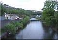

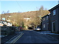
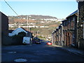


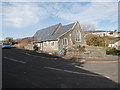
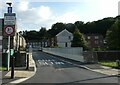
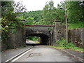
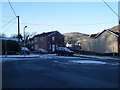

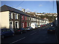
70 photos from this area
Area Information
Key information about the CF37 2RG including its size, population, and administrative classification.
- Area Type
- Postcode
- Area Size
- 3888 m²
- Population
- 1654
- Population Density
- 3191 people/km²
House Prices in CF37 2RG
29
Properties
£94,854
Average Sold Price
£36,000
Lowest Price
£160,500
Highest Price
Showing 29 properties
| Address | Type | Beds | Baths | Last Sale Price | Last Sale Date | |
|---|---|---|---|---|---|---|
| 19 Henry Street, Hopkinstown, Pontypridd, CF37 2RG | Terraced | 3 | 1 | £160,500 | Sep 2025 | |
| 12 Henry Street, Hopkinstown, Pontypridd, CF37 2RG | Terraced | 3 | 1 | £145,500 | Mar 2025 | |
| 20 Henry Street, Hopkinstown, Pontypridd, CF37 2RG | Terraced | 3 | 1 | £89,000 | Jun 2024 | |
| 22 Henry Street, Hopkinstown, Pontypridd, CF37 2RG | Terraced | 2 | 1 | £120,000 | Feb 2022 | |
| 7 Henry Street, Hopkinstown, Pontypridd, CF37 2RG | house | - | - | £127,000 | Dec 2021 | |
| 1 Henry Street, Hopkinstown, Pontypridd, CF37 2RG | Terraced | 3 | 1 | £114,950 | Jun 2020 | |
| 5 Henry Street, Hopkinstown, Pontypridd, CF37 2RG | Terraced | 3 | 1 | £112,000 | Nov 2019 | |
| 18 Henry Street, Hopkinstown, Pontypridd, CF37 2RG | house | - | - | £70,000 | Jan 2015 | |
| 15 Henry Street, Hopkinstown, Pontypridd, CF37 2RG | house | 3 | - | £64,000 | Feb 2012 | |
| 4 Henry Street, Hopkinstown, Pontypridd, CF37 2RG | house | - | - | £99,000 | May 2007 |
Page 1 of 3
Energy Efficiency in CF37 2RG
Amenities
Schools
| Rank | School | Type | Entry gender | Ages |
|---|
Explore more schools in this area
Go to Schools tabDemographics
Household Size
One person
most common
Accommodation Type
Houses
most common
Tenure
62
majority
Ethnic Group
White
most common
Religion
N/A
most common
Household Composition
N/A
most common
Age
47
median
Adults (30-64 years)
most common
Household Deprivation
N/A
with no deprivation
NS-SEC
21
in Lower managerial occupations
Explore more demographic insights in this area
Go to Demographics tabPlanning
Planning Constraints
- Flood RiskPremium
- Ramsar Wetland SitesPremium
- Area of Outstanding Natural BeautyPremium
- Protected Nature ReservePremium
- Protected WoodlandPremium
- Crime RiskPremium