Area Overview for CF15 7PQ
Photos of CF15 7PQ
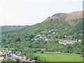
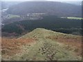
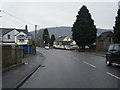
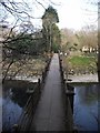
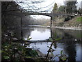
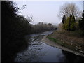
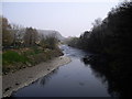
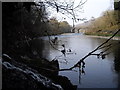
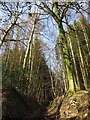
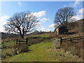
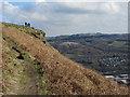
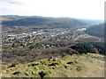
45 photos from this area
Area Information
Key information about the CF15 7PQ including its size, population, and administrative classification.
- Area Type
- Postcode
- Area Size
- 3.0 hectares
- Population
- 1647
- Population Density
- 1295 people/km²
House Prices in CF15 7PQ
20
Properties
£151,843
Average Sold Price
£59,950
Lowest Price
£230,000
Highest Price
Showing 20 properties
| Address | Type | Beds | Baths | Last Sale Price | Last Sale Date | |
|---|---|---|---|---|---|---|
| 48 Cardiff Road, Taffs Well, CF15 7PQ | house | - | - | £230,000 | Jul 2021 | |
| 50 Cardiff Road, Taffs Well, CF15 7PQ | Terraced | 2 | 1 | £177,500 | Mar 2021 | |
| 54 Cardiff Road, Taffs Well, CF15 7PQ | house | - | - | £159,950 | Jun 2018 | |
| 46 Cardiff Road, Taffs Well, CF15 7PQ | house | - | - | £209,500 | Jun 2018 | |
| 60 Cardiff Road, Taffs Well, CF15 7PQ | Terraced | 2 | 1 | £150,000 | Feb 2018 | |
| 56 Cardiff Road, Taffs Well, CF15 7PQ | Land | - | - | £76,000 | Apr 2007 | |
| 58 Cardiff Road, Taffs Well, CF15 7PQ | Terraced | - | - | £59,950 | Jul 1998 | |
| 3, Park View Court, 68 Cardiff Road, Taffs Well, CF15 7PQ | Flat | 4 | - | - | - | |
| 64 Cardiff Road, Taffs Well, CF15 7PQ | house | - | - | - | - | |
| A, 66 Cardiff Road, Taffs Well, CF15 7PQ | Flat | 4 | - | - | - |
Page 1 of 2
Energy Efficiency in CF15 7PQ
Amenities
Schools
| Rank | School | Type | Entry gender | Ages |
|---|
Explore more schools in this area
Go to Schools tabDemographics
Household Size
One person
most common
Accommodation Type
Houses
most common
Tenure
66
majority
Ethnic Group
White
most common
Religion
N/A
most common
Household Composition
N/A
most common
Age
47
median
Adults (30-64 years)
most common
Household Deprivation
N/A
with no deprivation
NS-SEC
39
in Lower managerial occupations
Explore more demographic insights in this area
Go to Demographics tabPlanning
Planning Constraints
- Flood RiskPremium
- Ramsar Wetland SitesPremium
- Area of Outstanding Natural BeautyPremium
- Protected Nature ReservePremium
- Protected WoodlandPremium
- Crime RiskPremium