Area Overview for Aberaman South Community
Photos of Aberaman South Community


Area Information
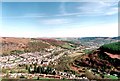
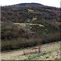
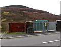
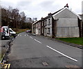
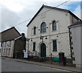
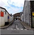
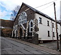
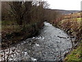
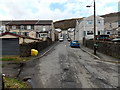
Aberaman South Community is a civil parish situated within the Rhondda Cynon Taf district of South Wales. This area lies to the south of Aberdare, occupying a distinct space in the Cynon Valley. You will find the settlement developed significantly during the nineteenth century following the opening of the Aberaman Colliery in 1845. Crawshay Bailey initiated this industrial expansion, which eventually led to the town merging with Cwmaman as urban areas grew together. The land was historically agricultural but transformed rapidly to house workers for mining operations. Streets such as Curre Street, Holford Street, Gwawr Street, and Lewis Street appeared to accommodate the influx of people. Though the many mines are now closed, the physical footprint of this industrial past remains. You are looking at a landscape shaped by heavy enterprise before it settled into its current parish boundaries covering 12.5 km². The community carries the legacy of the Powell Duffryn Steam Coal Company and the National Coal Board era. You will encounter remnants of this history in the local architecture and street patterns. This area offers a grounded sense of place for those who understand its layered industrial origins rather than a generic suburban feel. Living here means engaging with a neighbourhood that has evolved from a coal-mining hub into a residential parish. The community retains a strong historic identity through landmarks like the former Aberaman Hall and Institute, which served as a civic heart. Today, Aberaman presents a quiet residential zone distinct from the bustling commercial centers of the wider valley. It is a place defined by its specific location and the deep roots of its working-class history.
- Area Type
- Parish
- Area Size
- 12.5 km²
- Population
- Not available
- Population Density
- Not available
Demographics
The population profile of Aberaman South Community is distinctly mature. The median age in the parish is 70 years, indicating a largely retired resident base. This high figure suggests that the area functions as a retirement destination or a place where older generations remain settled. The most common age range spans the total population, but the skew toward older adults defines the daily rhythm of the neighbourhood. You will find that 65% of homes in Aberaman South Community are owner-occupied. This majority indicates a stable household where residents have stayed put for decades, likely having purchased properties built during or shortly after the post-war era. The area reflects a community where financial ties to the location are strong. Household composition and accommodation types show little variation from the national average for older demographics, though specific breakdowns for single-person households or empty nesters are not detailed in available records. You do not have data on the predominant ethnic group, but the high ownership rate suggests a long-standing local community. There is Information not available regarding religious affiliation, leaving the specific spiritual makeup of the parish unclear. Deprivation levels remain a relevant context for quality of life, although specific indices are not provided. The age structure means services are geared toward the elderly, with fewer young families driving commercial activity. Life here moves at a slower pace compared to denser urban centres. The demographic reality is clear: you are looking at a settled community of older residents who own their homes. This environment suits those seeking quiet retirement living rather than a youthful, fast-paced lifestyle.
Household Size
Accommodation Type
Tenure
Ethnic Group
Religion
Household Composition
Age
Household Deprivation
NS-SEC
Explore more demographic insights in this area
Go to Demographics tabPlanning
Planning Constraints
- Flood RiskPremium
- Ramsar Wetland SitesPremium
- Area of Outstanding Natural BeautyPremium
- Protected Nature ReservePremium
- Protected WoodlandPremium
- Crime RiskPremium