Area Overview for Treorchy Community
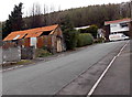
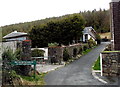
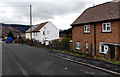
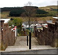
Photos of Treorchy Community
Area Information
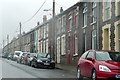
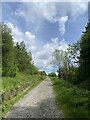
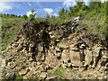
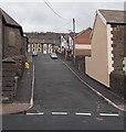
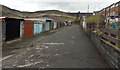
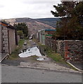
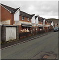
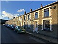
Treorchy Community forms a civil parish within the county borough of Rhondda Cynon Taf in Wales. This settlement covers an area of 13.3 km² and houses a population of 3,196 residents. Situated in the Rhondda Fawr valley, the community retains the layout and character of a former industrial town that developed along the main valley road. Originally established as a coal mining settlement in 1859, the area transformed from scattered farmhouses into a densely populated industrial hub under the ownership of the Marquess of Bute Estate. The geography supports a quiet, valley-based lifestyle distinct from the surrounding highlands. You will find the settlements of Cwmparc and Ynyswen integrated within this parish boundary. The community functions as a cultural and social centre, supported by local institutions that define daily life. Its history of mining has left a permanent mark on the streetscapes, yet the area adapted through diverse industries including clothing, electronics, and steel construction during the post-mining transition. Living in Treorchy Community means embracing a location defined by its deep valley setting and its evolution from a single-industry town into a multifaceted residential area. The population density averages 240 people per km², creating a neighbourhood feel without the extreme congestion of larger urban centres.
- Area Type
- Parish
- Area Size
- 13.3 km²
- Population
- 3196
- Population Density
- 240 people/km²
Demographics
The demographic profile of Treorchy Community reflects a mature population structure. The median age stands at 70 years, indicating a significant proportion of older adults reside here. This ageing profile suggests a community where retirement living or multi-generational cohabitation may be common. With 72% home ownership, the vast majority of households in this parish own their property outright or with a mortgage. This high level of ownership contrasts sharply with rental-heavy urban districts and points to long-term residents who have stayed since the decline of the coal industry. The population density of 240 people per km² suggests a settled environment rather than a transient one. While specific data on household composition types, predominant ethnic groups, and religious affiliations is not quantified in the current records, the overall picture remains one of stability. The area has successfully navigated industrial decline without suffering severe depopulation, unlike other parts of the Rhondda. The community infrastructure, including the Upper Treorchy Workingmen's Library and Institute, caters to this established resident base. You are likely to encounter long-standing families who have lived through the area's major economic shifts.
Household Size
Accommodation Type
Tenure
Ethnic Group
Religion
Household Composition
Age
Household Deprivation
NS-SEC
Explore more demographic insights in this area
Go to Demographics tabPlanning
Planning Constraints
- Flood RiskPremium
- Ramsar Wetland SitesPremium
- Area of Outstanding Natural BeautyPremium
- Protected Nature ReservePremium
- Protected WoodlandPremium
- Crime RiskPremium