Area Overview for Treherbert Community
Photos of Treherbert Community
Area Information
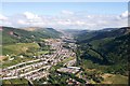
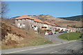
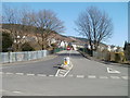
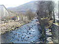
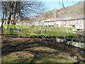
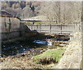
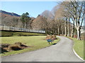
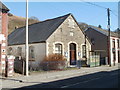
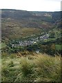
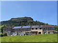
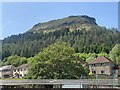
Treherbert Community sits at the uppermost end of the Rhondda Fawr valley in Rhondda Cynon Taf, Wales. This civil parish covers an area of 21.6 square kilometres and encompasses the historic districts of Blaencwm, Blaenrhondda, Tynewydd, and Penyrenglyn. Originally established by the Bute Estate in the 1850s as a grid-pattern colliery settlement, the village was first named in parish records in January 1855 after the Herbert earls of Pembroke. Prior to industrialisation, the region consisted of isolated farms, but the sinking of the Bute Merthyr Colliery shaft on Cwmsaerbren farm in 1855 sparked rapid population growth. Residents form a close-knit community defined by this deep industrial heritage, with the landscape still reflecting its mining past through historic structures. Daily life here revolves around former industrial sites and the natural surroundings of the valley. You will find yourself navigating a neighbourhood where 19th-century buildings often stand alongside early council housing constructed in the Eileen Place estate. The area retains a distinct identity separate from the broader Rhondda valley towns, offering a quiet residential experience rooted in a unique local history. Known locally as Treherbert, the parish remains a coloured canvas of its working-class roots, now transitioning towards new social enterprises like Forest Town. Living in Treherbert means appreciating a location that balances agricultural origins with a robust industrial legacy, all within a compact geographical footprint.
- Area Type
- Parish
- Area Size
- 21.6 km²
- Population
- Not available
- Population Density
- Not available
Demographics
The people of Treherbert form an ageing community, with a median age of 70 years. This high median age indicates that the area is predominantly inhabited by pensioners and residents in their senior years. The most common demographic group identified in the data spans the total age population, suggesting a very mature population structure. Home ownership stands at a significant level, with 62% of households in the parish owning their property outright or with a mortgage. This high rate of ownership suggests stability and long-term residence within the community. The data does not provide specific breakdowns for household composition types, predominant ethnic groups, or religious affiliations, but the ownership figure remains a defining statistic. You can expect a quiet, settled neighbourhood rather than a dynamic hub of young families or transient workers. The lack of youth and workforce data points to an area where residents have stayed for a lifetime. Living in Treherbert involves engaging with a demographic that has deep roots in the valley. The absence of detailed data on diversity or specific household sizes means you cannot assume a young, diverse workforce typical of modern economic hubs. Instead, the community reflects the demographic shifts common in former industrial zones of South Wales, where families often settle permanently.
Household Size
Accommodation Type
Tenure
Ethnic Group
Religion
Household Composition
Age
Household Deprivation
NS-SEC
Explore more demographic insights in this area
Go to Demographics tabPlanning
Planning Constraints
- Flood RiskPremium
- Ramsar Wetland SitesPremium
- Area of Outstanding Natural BeautyPremium
- Protected Nature ReservePremium
- Protected WoodlandPremium
- Crime RiskPremium