Area Overview for Taffs Well Community
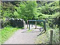
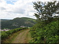
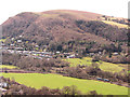
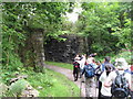
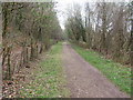
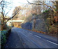
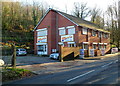
Photos of Taffs Well Community
Area Information
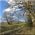
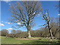
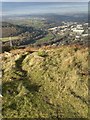
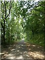
Taffs Well Community sits at the south-eastern tip of Rhondda Cynon Taf, acting as a gateway between the Merthyr Tydfil and Rhondda Valleys and Cardiff city centre. This civil parish spans 6.7 square kilometres of semi-rural landscape, positioned approximately six miles north-west of Cardiff. The village develops around the River Taff, offering residents a tranquil setting alongside Garth Mountain and Graig Mountain. You will find distinct districts including Glan-y-Llyn, Rhiw Ddar, Glan-y-Fordd, and Ty-Rhiw spreading out from the core village. Living in Taffs Well Community means residing in a place with deep historical roots. The area was first described as a hamlet in the early 1870s, named for its therapeutic tepid spring. Today, the community retains a village feel yet functions as a key commuter settlement for Cardiff. The Taff Trail winds through the neighbourhood, and the famous Castell Coch lies nearby. You travel via Junction 32 of the M4 motorway or the A470 road. Whether you seek proximity to the city or a quiet life away from urban bustle, this parish offers a specific blend of valley heritage and modern accessibility that defines daily life here.
- Area Type
- Parish
- Area Size
- 6.7 km²
- Population
- Not available
- Population Density
- Not available
Demographics
The demographic profile of Taffs Well Community reflects an established settlement with a significantly older population structure. The median age for residents reaches 70 years, indicating a community where many households consist of adults and seniors rather than young families or university students. While specific figures for age distribution ranges are not broken down in the current data, the median age of 70 shapes the social fabric and service needs of the area. Home ownership stands as the dominant form of accommodation within the parish, with 75% of residents owning their homes outright. This high rate suggests a stable, long-term resident population invested in the local community. Although the total number of households and details regarding specific ethnic groups or religious affiliations are not detailed in the provided statistics, the prevailing age and ownership data point towards a traditional Welsh village environment. You should anticipate a neighbourhood where long-standing families have shaped local traditions, distinct from areas with high rental turnover or transient populations. This demographic reality defines the quiet, steady pace of life found in most homes in Taffs Well Community.
Household Size
Accommodation Type
Tenure
Ethnic Group
Religion
Household Composition
Age
Household Deprivation
NS-SEC
Explore more demographic insights in this area
Go to Demographics tabPlanning
Planning Constraints
- Flood RiskPremium
- Ramsar Wetland SitesPremium
- Area of Outstanding Natural BeautyPremium
- Protected WoodlandPremium
- Crime RiskPremium