Area Overview for Ystrad Community
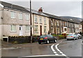
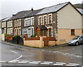
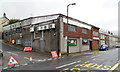
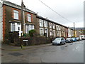
Photos of Ystrad Community
Area Information
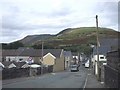
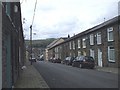
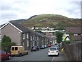
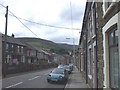
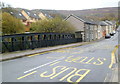
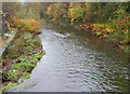
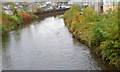
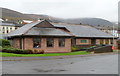
Living in Ystrad Community means residing in a small, tight-knit rural settlement within the Rhondda Fawr valley in Wales. You will find yourself in a former coal-mining village defined by its history rather than a traditional commercial high street. The area covers a compact size of 6.9 km², which creates an intimate environment where daily activities often happen within close proximity to your front door. Ystrad, also known locally as Ystrad Rhondda, sits at coordinates 51.64568457235508, -3.476443180476463 and falls under the postcode CF41 7PX. Its identity derives from the historic parish of Ystradyfodwg, an old name meaning Vale of Tyfodwg that referenced low-lying meadowland near a river. Daily life here reflects the character of a self-contained village where ancient paths once met at crossroads featuring a water mill and early religious sites. The community possesses a distinct sense of place shaped by industrial heritage and rural surroundings. You are part of a population of approximately 1,456 people who share a strong community feel typical of ex-mining towns in the South Wales Coalfield. The area surrounds named landmarks such as Nebo Baptist Chapel and St. Stephen's Church, giving location a sense of continuity despite the passage of time. This is not a sprawling suburb but a concentrated village centre where the past remains visible in the architecture and street names.
- Area Type
- Parish
- Area Size
- 6.9 km²
- Population
- Not available
- Population Density
- Not available
Demographics
The community in Ystrad Community is dominated by an older population, with a median age of 70 years. This demographic profile suggests a neighbourhood where many residents are retirees or long-term locals rather than young families or students. You will find that the most common age range corresponds to the total population figures, indicating a significant concentration of senior citizens. A substantial 64% of households own their accommodation, placing ownership levels well above the national average for rural Wales. This high rate of home ownership points to a stable community with deep roots in the local area. Household composition data is currently aggregated as a total, meaning individual breakdowns between single-person homes or families are not separately detailed in the available records. Similarly, specific details regarding predominant ethnic groups, religious affiliations, or detailed accommodation type statistics are not provided in the dataset. You cannot identify specific demographic splits without further granular data. Despite these missing descriptors, the age profile paints a clear picture of settlement. The high median age explains the quiet, perhaps slower-paced nature of daily life in Ystrad. There is a lack of data on youth migration or new arrivals, suggesting the population has remained relatively static over recent years. When considering who lives here, you are looking at a community where those who were born or settled there likely remain.
Household Size
Accommodation Type
Tenure
Ethnic Group
Religion
Household Composition
Age
Household Deprivation
NS-SEC
Explore more demographic insights in this area
Go to Demographics tabPlanning
Planning Constraints
- Flood RiskPremium
- Ramsar Wetland SitesPremium
- Area of Outstanding Natural BeautyPremium
- Protected Nature ReservePremium
- Protected WoodlandPremium
- Crime RiskPremium