Area Overview for Llantrisant Community
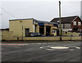
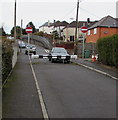
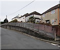
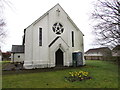
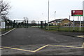
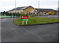
Photos of Llantrisant Community

Area Information
Living in Llantrisant Community offers a distinct perspective on life in the Rhondda Cynon Taf county borough. This civil parish sits on a hilltop at 174 m above sea level, situated directly on the River Ely and Afon Clun. The area's name translates to "Parish of the Three Saints," referencing the Illtyd, Gwynno, and Dyfodwg dedicated to the local church that has stood since the seventh century. You are exploring a town within the historic county of Glamorgan that spans 16.0 km². The population of 2,443 residents creates a tight-knit atmosphere without overwhelming density, averaging 153 people per square kilometre. History runs deep here, with settlements dating back over three millennia. Bronze Age burial mounds and an Iron Age hillfort known as Caerau Hillfort border the settlement. A continuous community existed from at least the sixth century, supported by poets like Aneurin. Richard de Clare seized the land around 1246 to build Llantrisant Castle, and the parish gained a royal charter in 1346. Residents benefit from local heritage sites including Guildhall, a Grade II listed 14th-century building, and the former Union Workhouse built in 1884. The Royal Mint, established in 1968, remains a significant presence and employer within the town. For those considering homes in Llantrisant Community, you step into an environment where ancient traditions, such as the Beating of the Bounds, persist alongside modern amenities like Penuel Chapel and Dr Price's statue. The CF72 postcode area defines the modern boundaries of this historic location.
- Area Type
- Parish
- Area Size
- 16.0 km²
- Population
- 2443
- Population Density
- 153 people/km²
Demographics
The demographic profile of Llantrisant Community reveals a settlement defined by its residents. The median age for the population is 70 years old, indicating a community composed largely of older adults. This high median age aligns with traditional market towns in the region. You will find that 74% of households are owner-occupied, suggesting a strong culture of home ownership and long-term residency. The remaining households involve renting or other tenure types, though these specific figures are not broken down in the current data. Household composition data is available in total form, yet the specific breakdown into families, single-person households, or couples is not detailed in the provided statistics. Similarly, details regarding predominant ethnic groups and religious affiliations are recorded as totals but lack specific percentage splits. This absence of granular demographic slicing means the community feels homogenous in its general public presentation. The most common age range is recorded as "Age: Total," which does not provide a specific bracket for younger demographics. For a prospective buyer, a median age of 70 suggests quieter streets and neighbours who may be downsizing or seeking a retirement-friendly environment. The area does not cater primarily to young families or students based on the age data available. You should expect a environment where property values may reflect the needs of this older population. While specific deprivation data is not included in the provided figures, the high level of home ownership often correlates with stable, established neighbourhoods. The community reflects a slow-paced lifestyle associated with higher age brackets and a strong attachment to the local land.
Household Size
Accommodation Type
Tenure
Ethnic Group
Religion
Household Composition
Age
Household Deprivation
NS-SEC
Explore more demographic insights in this area
Go to Demographics tabPlanning
Planning Constraints
- Flood RiskPremium
- Ramsar Wetland SitesPremium
- Area of Outstanding Natural BeautyPremium
- Protected Nature ReservePremium
- Protected WoodlandPremium
- Crime RiskPremium