Area Overview for Llanharry Community
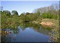
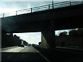
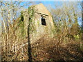
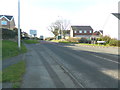
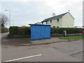
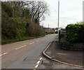
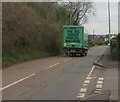
Photos of Llanharry Community

Area Information
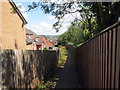
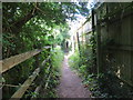
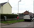
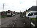
Llanharry Community is a civil parish in Rhondda Cynon Taf, Wales, covering an area of 7.4 km² with a population of 1,429. The community functions as a former industrial village that has transitioned into a modern commuter area, situated just north of the M4 motorway. You can find it approximately two miles south of Llanharan, placing it within a region historically linked to iron mining and coal. This shift from industrial work to residence is evident in the local housing, which now supports families working in surrounding cities. The area retains a quiet, residential feel while offering direct access to major transport links. Living in Llanharry means being part of a distinct neighbourhood that balances the legacy of a mining past with the practical demands of modern commuting. The proximity to the M4 makes daily travel efficient, yet the village maintains a character separate from the wider urban sprawl. For those seeking homes in Llanharry Community, the location offers a specific blend of historic context and contemporary convenience. The parish serves as an electoral ward, confirming its established administrative role within the county borough. Daily life revolves around this stable community structure, where the pace has slowed from heavy industry to a more settled domestic rhythm.
- Area Type
- Parish
- Area Size
- 7.4 km²
- Population
- 1429
- Population Density
- 192 people/km²
Demographics
The population of Llanharry Community is defined by a significant proportion of older residents, with a median age of 70. This demographic profile suggests the area attracts retirees or long-term residents who have settled in the parish. Home ownership stands at 79%, indicating that the majority of households own their property outright or with a mortgage rather than renting. This high rate of ownership typically points to a stable community where families and individuals invest in their local environment. The abundance of owner-occupied homes contrasts with areas where rental markets dominate, suggesting a traditional housing stock built over generations. Accommodation types in the area reflect this settled nature, though specific breakdowns are not detailed in the available information. The community does not publish specific data on ethnicity or religion, but the high ownership rate often correlates with longer-term residency. For those considering living in Llanharry Community, the low population density of 192 people per km² ensures a spacious environment. You will find fewer homes in Llanharry Community compared to densely populated urban wards. The age profile and ownership data together paint a picture of a place where people stay rather than move through. This stability benefits local services and creates a predictable environment for new residents. The community composition remains consistent, with fewer transient populations affecting the social dynamic.
Household Size
Accommodation Type
Tenure
Ethnic Group
Religion
Household Composition
Age
Household Deprivation
NS-SEC
Explore more demographic insights in this area
Go to Demographics tabPlanning
Planning Constraints
- Flood RiskPremium
- Ramsar Wetland SitesPremium
- Area of Outstanding Natural BeautyPremium
- Protected Nature ReservePremium
- Protected WoodlandPremium
- Crime RiskPremium