Area Overview for Ferndale Community
Photos of Ferndale Community


Area Information
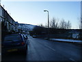
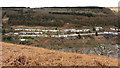
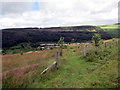
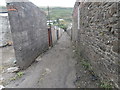
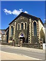
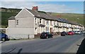
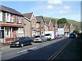
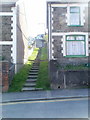
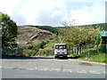
Ferndale Community is a civil parish situated in the Rhondda Fach Valley within Rhondda Cynon Taf, Wales. Neighbouring Blaenllechau, Maerdy and Tylorstown, this parish covers an area of 3.8 km². Historically significant as the site of the first intensively industrialised community in the Rhondda Valley, the town thrived from the mid-19th century with its coal mining legacy. The former Ferndale Colliery operated from 1857 to 1959, shaping the local character and employment patterns for generations. Today, the area retains tangible links to its past, including the Wesleyan Methodist Chapel rebuilt in 1893 and the historic Ferndale Workmen's General Hospital established in 1891. The site of the former Taff Vale Railway station also marks a period of extensive industrial transport until passenger services ceased in 1964. Local life revolves around established community institutions like The Strand shopping centre and the various chapels that date back to the 1860s and 1880s. This distinct heritage offers residents a deep sense of place within the Welsh town and community landscape. Prospective buyers can find homes in Ferndale Community that reflect this enduring historical atmosphere and local identity.
- Area Type
- Parish
- Area Size
- 3.8 km²
- Population
- Not available
- Population Density
- Not available
Demographics
The population living in Ferndale Community exhibits a very distinct age profile, with a median age of 70. This figure indicates a population heavily weighted towards older residents, reflecting the broader demographic trends often found in established mining valleys across Wales. Almost all survey data lists the total age range without highlighting specific younger cohorts, suggesting a significant concentration of retirees. Home ownership stands at 73%, meaning nearly three out of four households own their property outright or with a mortgage. This high percentage points towards an area where long-term residents have settled permanently rather than a transient or young rental market. Household composition data is recorded as a total, offering no breakdown of single-parent families, childless couples, or multi-generational living arrangements. Despite the high ownership rate, the age structure implies a community where young families and children may be less common than in urban centres. The predominant ethnic group, religion, and other specific demographic breakdowns are not detailed in the available records, leaving the cultural mosaic less clear to the outside observer.
Household Size
Accommodation Type
Tenure
Ethnic Group
Religion
Household Composition
Age
Household Deprivation
NS-SEC
Explore more demographic insights in this area
Go to Demographics tabPlanning
Planning Constraints
- Flood RiskPremium
- Ramsar Wetland SitesPremium
- Area of Outstanding Natural BeautyPremium
- Protected Nature ReservePremium
- Protected WoodlandPremium
- Crime RiskPremium