Area Overview for Cwmbach Community
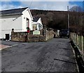
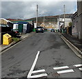
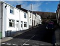
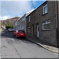
Photos of Cwmbach Community


Area Information
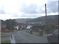
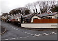
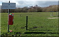
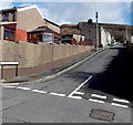
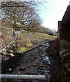
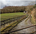
Cwmbach Community is a village and civil parish situated in Rhondda Cynon Taf, within the Cynon Valley of South Wales. This small settlement sits immediately adjacent to Aberdare town, with boundaries stretching from the Arberdare train station and Abernant area at one end to Cefnpennar at the other. The name Cwmbach translates to 'Little Valley' in Welsh, reflecting its geography, and it covers an area of 5.3 km². With a population of 5,117, the village mixes social and private housing and sits near the historic Aberdare Canal and the Cynon Trail. The local character blends a rich industrial past with modern developments. Historically, coal mining defined the area until closures caused significant emigration. Today, large new-build estates developed after the clearing of Tirfounder Fields in 2001 sit alongside traditional homes. Residents have access to local amenities including a Co-op, small general stores, and the Tirfounder Fields retail park which houses Asda, Halfords and Greggs. For those seeking community life, the Cwmbach Community Wetlands offer a dedicated nature reserve featuring lagoons, marshes and woodland. Living in Cwmbach Community means residing in a location that combines historical charm with modern necessities, just minutes away from the town centre of Aberdare.
- Area Type
- Parish
- Area Size
- 5.3 km²
- Population
- Not available
- Population Density
- Not available
Demographics
The demographic profile of Cwmbach Community indicates an established, older population. The median age for residents stands at 70 years, making it a village where most people are in their senior years. While specific data regarding the total age breakdown is listed as 'Total' in the provided statistics, the median figure confirms that this is not a young, growing city but a settled community. Approximately 70% of households in Cwmbach are owner-occupied, suggesting a strong sense of long-term settlement among residents. The area features a mix of household compositions, though specific details on the exact percentage of families versus single-person households are categorised generally under 'total' data points. Consequently, the housing stock likely reflects the needs of an older demographic, with many homes having been passed down or purchased for retirement. The community is defined by its stability rather than rapid demographic shifts. When considering homes in Cwmbach, you are looking at an area where people tend to stay put, resulting in a quiet, predictable neighbourhood far from the demographic volatility found in newer university towns. This stability is a tangible feature of daily life for everyone who calls Cwmbach Community home.
Household Size
Accommodation Type
Tenure
Ethnic Group
Religion
Household Composition
Age
Household Deprivation
NS-SEC
Explore more demographic insights in this area
Go to Demographics tabPlanning
Planning Constraints
- Flood RiskPremium
- Ramsar Wetland SitesPremium
- Area of Outstanding Natural BeautyPremium
- Protected Nature ReservePremium
- Protected WoodlandPremium
- Crime RiskPremium