Area Overview for Llantwit Fardre Community
Photos of Llantwit Fardre Community


Area Information
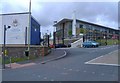
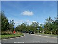
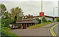
Llantwit Fardre Community is a civil parish in Rhondda Cynon Taf, South Wales, spanning 16.9 km² with a total population of 7,036. The area combines historical depth with modern suburban living, centred around coordinates 51.573437, -3.29644. Its name derives from "The Church of St Illtud on the Home Farm of the Prince," reflecting roots that stretch back to the Bronze Age and a possible 5th-century monastic community. While the parish council formed under the 1894 Local Government Act, the community has transitioned from a small rural village to an extensive housing development surrounded by former farmland since the post-1950s era. Today, residents primarily commute for work following the decline of local coal mining, whereas the early 17th-century economy relied on stone quarrying and coal extraction. You can explore villages within the parish, including Church Village and Tonteg, which houses the historic 12th-century motte castle, Tomen-y-Clawdd. Living in Llantwit Fardre offers a direct connection to local heritage, from the 6th-century Church of St Illtud to the 1959-1973 Gilbern car manufacturing period. The community now serves as a residential hub where residents access services in a setting defined by its deep industrial and religious history.
- Area Type
- Parish
- Area Size
- 16.9 km²
- Population
- 7036
- Population Density
- 417 people/km²
Demographics
The demographic profile of Llantwit Fardre Community reveals significant contrasts with the national average. The median age stands at 70 years, placing this area distinctly towards the end of the lifespan spectrum compared to most other regions. While specific age range breakdowns beyond the total are not detailed in the available records, the high median age suggests a community composed largely of older residents. Home ownership is exceptionally high at 90%, which is substantially above the national average. This figure indicates that the majority of households in Llantwit Fardre are owner-occupiers rather than private renters. Detailed data on household composition, predominant ethnic groups, and religious affiliations are currently unavailable, but the 90% ownership rate implies a stable, settled population. You are more likely to find established families or mature individuals in homes here. The high level of home ownership often correlates with longer tenure and a stronger community bond, as residents are highly invested in the local area. With a population of 7,036 spread across 16.9 km², the area maintains a moderate density while preserving its suburban character away from major urban centres in Wales.
Household Size
Accommodation Type
Tenure
Ethnic Group
Religion
Household Composition
Age
Household Deprivation
NS-SEC
Explore more demographic insights in this area
Go to Demographics tabPlanning
Planning Constraints
- Flood RiskPremium
- Ramsar Wetland SitesPremium
- Area of Outstanding Natural BeautyPremium
- Protected Nature ReservePremium
- Protected WoodlandPremium
- Crime RiskPremium