Area Overview for Aberdare East Community
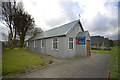
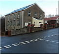
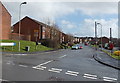
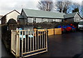
Photos of Aberdare East Community


Area Information
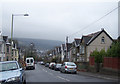
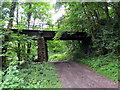
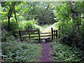
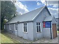
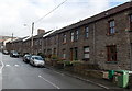
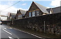
You are entering Aberdare East Community, a local government division and electoral ward located in Rhondda Cynon Taf, Wales. This community encompasses the main town of Aberdare while also including the villages of Robertstown and Abernant. The area sits within the Cynon Valley at coordinates 51.714098, -3.439116 and falls under the CF44 postcode district. Residents enjoy a lifestyle embedded within historical layers dating back to the Middle Ages. The first reference to this location appears in a monastic charter from 1203, centred around the Church of St John the Baptist. Rapid expansion followed the discovery of coal and iron deposits in the early 19th century. The parish population grew from 1,486 in 1801 to over 32,000 by 1861. Ironworks began operation around 1799 and coal mining activities expanded significantly thereafter. The modern community of Aberdare East was formally established on 1 December 2016, when the former Aberdare community was split into two distinct entities. Despite this administrative change, the area retains its character as a significant urban centre within the valley.
- Area Type
- Parish
- Area Size
- 6.7 km²
- Population
- Not available
- Population Density
- Not available
Demographics
You will find a specific age profile within the homes of Aberdare East Community. The median age for residents is 70 years. The most common age range reported in the data covers the total population, indicating a broad spread of residents across various life stages. This demographic structure informs how the community functions day to day. Home ownership stands at 62 percent of total households in Aberdare East Community. This figure suggests a stable residential market where a majority of residents own their living space. Household composition data reflects the total population structure without specifying individual breakdowns beyond the aggregate figures. Accommodation type statistics also cover the total inventory of dwellings in the area. Ethnically, the predominant group is recorded as the total population category available in the dataset. Religious affiliation follows the same reporting pattern, covering the total resident population. You should note that the community reflects the broader trends of Rhondda Cynon Taf through these aggregate demographic indicators.
Household Size
Accommodation Type
Tenure
Ethnic Group
Religion
Household Composition
Age
Household Deprivation
NS-SEC
Explore more demographic insights in this area
Go to Demographics tabPlanning
Planning Constraints
- Flood RiskPremium
- Ramsar Wetland SitesPremium
- Area of Outstanding Natural BeautyPremium
- Protected Nature ReservePremium
- Protected WoodlandPremium
- Crime RiskPremium