Area Overview for SY22 6SW
Photos of SY22 6SW
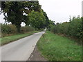
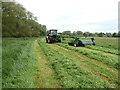
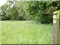
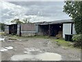
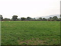
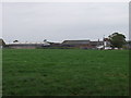
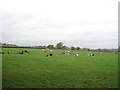
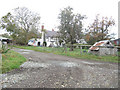
9 photos from this area
Area Information
Key information about the SY22 6SW including its size, population, and administrative classification.
- Area Type
- Postcode
- Area Size
- 71.4 hectares
- Population
- 1854
- Population Density
- 98 people/km²
House Prices in SY22 6SW
19
Properties
£392,250
Average Sold Price
£264,000
Lowest Price
£575,000
Highest Price
Showing 19 properties
| Address | Type | Beds | Baths | Last Sale Price | Last Sale Date | |
|---|---|---|---|---|---|---|
| Wrexham House, Domgay Road, Four Crosses, Llanymynech, SY22 6SW | Detached | 4 | 3 | £380,000 | Jul 2023 | |
| The Beeches, Domgay Road, Four Crosses, Llanymynech, SY22 6SW | Bungalow | - | - | £575,000 | Nov 2021 | |
| Erw Las, Domgay Road, Four Crosses, Llanymynech, SY22 6SW | house | - | - | £350,000 | Oct 2018 | |
| Millennium House, Domgay Road, Four Crosses, Llanymynech, SY22 6SW | Detached | - | - | £264,000 | Sep 2008 | |
| Leahurst, Domgay Road, Four Crosses, Llanymynech, SY22 6SW | Detached | 5 | 3 | - | - | |
| Domgay Hall, Domgay Road, Four Crosses, Llanymynech, SY22 6SW | house | - | - | - | - | |
| Hill View, Domgay Road, Four Crosses, Llanymynech, SY22 6SW | house | 3 | 1 | - | - | |
| VERCO HOUSE, DOMGAY ROAD, Four Crosses, Llanymynech, SY22 6SW | Unknown | - | - | - | - | |
| Hayfield, Domgay Road, Four Crosses, Llanymynech, SY22 6SW | Detached | - | - | - | - | |
| Hamilton, Domgay Road, Four Crosses, Llanymynech, SY22 6SW | Bungalow | - | - | - | - |
Page 1 of 2
Energy Efficiency in SY22 6SW
Amenities
Schools
| Rank | School | Type | Entry gender | Ages |
|---|
Explore more schools in this area
Go to Schools tabDemographics
Household Size
Two person
most common
Accommodation Type
Houses
most common
Tenure
77
majority
Ethnic Group
White
most common
Religion
N/A
most common
Household Composition
N/A
most common
Age
47
median
Adults (30-64 years)
most common
Household Deprivation
N/A
with no deprivation
NS-SEC
32
in Lower managerial occupations
Explore more demographic insights in this area
Go to Demographics tabPlanning
Planning Constraints
- Flood RiskPremium
- Ramsar Wetland SitesPremium
- Area of Outstanding Natural BeautyPremium
- Protected Nature ReservePremium
- Protected WoodlandPremium
- Crime RiskPremium