Area Overview for SY22 6HF
Photos of SY22 6HF
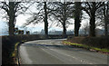
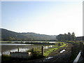
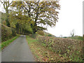
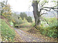

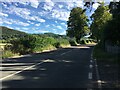
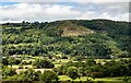
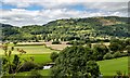
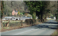
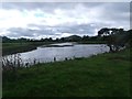
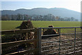
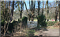
12 photos from this area
Area Information
Key information about the SY22 6HF including its size, population, and administrative classification.
- Area Type
- Postcode
- Area Size
- 48.7 hectares
- Population
- 2399
- Population Density
- 18 people/km²
House Prices in SY22 6HF
26
Properties
£172,670
Average Sold Price
£38,800
Lowest Price
£387,000
Highest Price
Showing 26 properties
| Address | Type | Beds | Baths | Last Sale Price | Last Sale Date | |
|---|---|---|---|---|---|---|
| 19 Cae Dafydd, Meifod, SY22 6HF | Detached | 2 | - | £315,000 | Aug 2025 | |
| 18 Cae Dafydd, Meifod, SY22 6HF | Detached | 3 | 2 | £295,000 | Sep 2024 | |
| 16 Cae Dafydd, Meifod, SY22 6HF | Detached | 3 | 2 | £256,500 | Feb 2023 | |
| 7 Cae Dafydd, Meifod, SY22 6HF | Bungalow | - | - | £175,000 | Sep 2022 | |
| 22 Cae Dafydd, Meifod, SY22 6HF | Bungalow | - | - | £310,000 | Sep 2021 | |
| 25 Cae Dafydd, Meifod, SY22 6HF | house | - | - | £387,000 | Sep 2021 | |
| 4 Cae Dafydd, Meifod, SY22 6HF | Terraced | 3 | 2 | £148,000 | Oct 2020 | |
| 14 Cae Dafydd, Meifod, SY22 6HF | Detached | 3 | 2 | £158,500 | Jan 2017 | |
| 15 Cae Dafydd, Meifod, SY22 6HF | Detached | - | - | £170,000 | Mar 2016 | |
| 23 Cae Dafydd, Meifod, SY22 6HF | Bungalow | - | - | £230,000 | Sep 2015 |
Page 1 of 3
Energy Efficiency in SY22 6HF
Amenities
Schools
| Rank | School | Type | Entry gender | Ages |
|---|
Explore more schools in this area
Go to Schools tabDemographics
Household Size
Two person
most common
Accommodation Type
Houses
most common
Tenure
79
majority
Ethnic Group
White
most common
Religion
N/A
most common
Household Composition
N/A
most common
Age
47
median
Adults (30-64 years)
most common
Household Deprivation
N/A
with no deprivation
NS-SEC
33
in Lower managerial occupations
Explore more demographic insights in this area
Go to Demographics tabPlanning
Planning Constraints
- Flood RiskPremium
- Ramsar Wetland SitesPremium
- Area of Outstanding Natural BeautyPremium
- Protected Nature ReservePremium
- Protected WoodlandPremium
- Crime RiskPremium