Area Overview for SY22 5AA
Photos of SY22 5AA
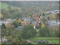
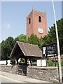
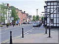
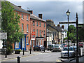
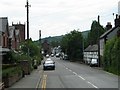
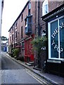
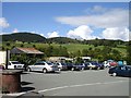
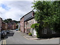
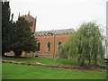
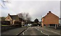
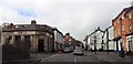
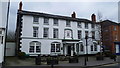
80 photos from this area
Area Information
Key information about the SY22 5AA including its size, population, and administrative classification.
- Area Type
- Postcode
- Area Size
- 1.4 hectares
- Population
- 1585
- Population Density
- 38 people/km²
House Prices in SY22 5AA
19
Properties
£108,100
Average Sold Price
£75,000
Lowest Price
£142,000
Highest Price
Showing 19 properties
| Address | Type | Beds | Baths | Last Sale Price | Last Sale Date | |
|---|---|---|---|---|---|---|
| 25 High Street, Llanfyllin, SY22 5AA | Retail | 2 | 1 | £104,500 | Mar 2019 | |
| 3, The Stables, High Street, Llanfyllin, SY22 5AA | house | 2 | - | £136,000 | Dec 2017 | |
| Brynteg, High Street, Llanfyllin, SY22 5AA | house | - | - | £75,000 | Oct 2016 | |
| 2, The Stables, High Street, Llanfyllin, SY22 5AA | house | 2 | - | £83,000 | Dec 2014 | |
| Gwynfa, High Street, Llanfyllin, SY22 5AA | house | - | - | £142,000 | Oct 2008 | |
| 21 High Street, Llanfyllin, SY22 5AA | Semi-detached | 3 | 1 | - | - | |
| Rhiwlas, High Street, Llanfyllin, SY22 5AA | Detached | 3 | 1 | - | - | |
| Tai Clochydd, 18 High Street, Llanfyllin, SY22 5AA | house | - | - | - | - | |
| Park View, High Street, Llanfyllin, SY22 5AA | Detached | - | - | - | - | |
| Parkside, High Street, Llanfyllin, SY22 5AA | Detached | - | - | - | - |
Page 1 of 2
Energy Efficiency in SY22 5AA
Amenities
Schools
| Rank | School | Type | Entry gender | Ages |
|---|
Explore more schools in this area
Go to Schools tabDemographics
Household Size
Two person
most common
Accommodation Type
Houses
most common
Tenure
66
majority
Ethnic Group
White
most common
Religion
N/A
most common
Household Composition
N/A
most common
Age
47
median
Adults (30-64 years)
most common
Household Deprivation
N/A
with no deprivation
NS-SEC
28
in Lower managerial occupations
Explore more demographic insights in this area
Go to Demographics tabPlanning
Planning Constraints
- Flood RiskPremium
- Ramsar Wetland SitesPremium
- Area of Outstanding Natural BeautyPremium
- Protected Nature ReservePremium
- Protected WoodlandPremium
- Crime RiskPremium