Area Overview for SY21 7QD
Photos of SY21 7QD
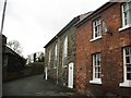
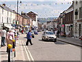
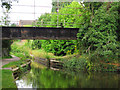
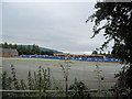
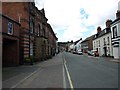

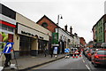
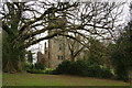
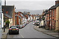
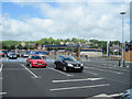

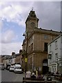
100 photos from this area
Area Information
Key information about the SY21 7QD including its size, population, and administrative classification.
- Area Type
- Postcode
- Area Size
- 2.0 hectares
- Population
- 2202
- Population Density
- 316 people/km²
House Prices in SY21 7QD
36
Properties
£150,500
Average Sold Price
£53,000
Lowest Price
£290,000
Highest Price
Showing 36 properties
| Address | Type | Beds | Baths | Last Sale Price | Last Sale Date | |
|---|---|---|---|---|---|---|
| Sunnyside, 3 Croft Road, Welshpool, SY21 7QD | Bungalow | - | - | £185,000 | Apr 2025 | |
| 28A Croft Road, Welshpool, SY21 7QD | Detached | 3 | 2 | £290,000 | Oct 2022 | |
| 22 Croft Road, Welshpool, SY21 7QD | Bungalow | 2 | 1 | £162,000 | Oct 2020 | |
| 24 Croft Road, Welshpool, SY21 7QD | Bungalow | - | - | £145,000 | Jun 2019 | |
| 31 Croft Road, Welshpool, SY21 7QD | Terraced | 2 | 1 | £94,000 | May 2018 | |
| 47 Croft Road, Welshpool, SY21 7QD | house | - | - | £136,000 | Aug 2014 | |
| Teifi Hill, 17 Croft Road, Welshpool, SY21 7QD | Detached | - | - | £195,000 | Feb 2013 | |
| 26 Croft Road, Welshpool, SY21 7QD | Detached | - | - | £158,000 | Aug 2004 | |
| Crossways, 1 Croft Road, Welshpool, SY21 7QD | Detached | - | - | £87,000 | Oct 2002 | |
| 45 Croft Road, Welshpool, SY21 7QD | Semi-detached | - | - | £53,000 | Aug 1997 |
Page 1 of 4
Energy Efficiency in SY21 7QD
Amenities
Schools
| Rank | School | Type | Entry gender | Ages |
|---|
Explore more schools in this area
Go to Schools tabDemographics
Household Size
One person
most common
Accommodation Type
Houses
most common
Tenure
57
majority
Ethnic Group
White
most common
Religion
N/A
most common
Household Composition
N/A
most common
Age
47
median
Adults (30-64 years)
most common
Household Deprivation
N/A
with no deprivation
NS-SEC
26
in Lower managerial occupations
Explore more demographic insights in this area
Go to Demographics tabPlanning
Planning Constraints
- Flood RiskPremium
- Ramsar Wetland SitesPremium
- Area of Outstanding Natural BeautyPremium
- Protected Nature ReservePremium
- Protected WoodlandPremium
- Crime RiskPremium