Area Overview for SY21 0QX
Photos of SY21 0QX
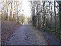
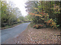
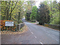
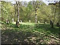
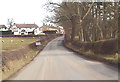
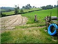
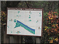
10 photos from this area
Area Information
Key information about the SY21 0QX including its size, population, and administrative classification.
- Area Type
- Postcode
- Area Size
- 3.4 hectares
- Population
- 1706
- Population Density
- 27 people/km²
House Prices in SY21 0QX
6
Properties
£144,500
Average Sold Price
£72,500
Lowest Price
£180,000
Highest Price
Showing 6 properties
| Address | Type | Beds | Baths | Last Sale Price | Last Sale Date | |
|---|---|---|---|---|---|---|
| Bryn Haul, High Street, Llanfair Caereinion, Welshpool, SY21 0QX | house | - | - | £154,000 | Oct 2024 | |
| Ty Mawr, High Street, Llanfair Caereinion, Welshpool, SY21 0QX | Semi-detached | 4 | 1 | £175,000 | Jan 2020 | |
| Bryn Llewelyn, B 4385 From High Street Llanfair Caereinion To Junction With C 2130, Llanfair Caereinion, Welshpool, SY21 0QX | Terraced | 4 | 3 | £180,000 | Feb 2018 | |
| Deri Cottage, High Street, Llanfair Caereinion, Welshpool, SY21 0QX | Detached | 2 | - | £141,000 | Jan 2016 | |
| Argoed, High Street, Llanfair Caereinion, Welshpool, SY21 0QX | house | - | - | £72,500 | Dec 2014 | |
| Top Llan, High Street, Llanfair Caereinion, Welshpool, SY21 0QX | Detached | - | - | - | - |
Energy Efficiency in SY21 0QX
Amenities
Schools
| Rank | School | Type | Entry gender | Ages |
|---|
Explore more schools in this area
Go to Schools tabDemographics
Household Size
Two person
most common
Accommodation Type
Houses
most common
Tenure
74
majority
Ethnic Group
White
most common
Religion
N/A
most common
Household Composition
N/A
most common
Age
47
median
Adults (30-64 years)
most common
Household Deprivation
N/A
with no deprivation
NS-SEC
30
in Lower managerial occupations
Explore more demographic insights in this area
Go to Demographics tabPlanning
Planning Constraints
- Flood RiskPremium
- Ramsar Wetland SitesPremium
- Area of Outstanding Natural BeautyPremium
- Protected Nature ReservePremium
- Protected WoodlandPremium
- Crime RiskPremium