Area Overview for SY17 5PP
Photos of SY17 5PP
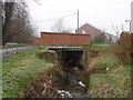
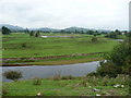
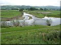
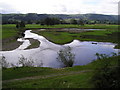
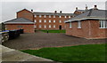
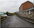
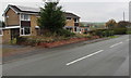
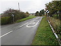
67 photos from this area
Area Information
Key information about the SY17 5PP including its size, population, and administrative classification.
- Area Type
- Postcode
- Area Size
- 16.6 hectares
- Population
- 2272
- Population Density
- 25 people/km²
House Prices in SY17 5PP
5
Properties
£240,500
Average Sold Price
£200,000
Lowest Price
£305,000
Highest Price
Showing 5 properties
| Address | Type | Beds | Baths | Last Sale Price | Last Sale Date | |
|---|---|---|---|---|---|---|
| Southfield, Maes Glas, Caersws, SY17 5PP | Bungalow | 3 | 1 | £305,000 | Mar 2024 | |
| Einlle, Maes Glas, Caersws, SY17 5PP | Bungalow | - | - | £222,500 | Jun 2022 | |
| Garreg Wen, Maes Glas, Caersws, SY17 5PP | Bungalow | 3 | 1 | £245,000 | Jun 2021 | |
| Glynderw, Maes Glas, Caersws, SY17 5PP | Bungalow | - | - | £230,000 | Oct 2020 | |
| Ashbury, Maes Glas, Caersws, SY17 5PP | Bungalow | 2 | - | £200,000 | Dec 2016 |
Energy Efficiency in SY17 5PP
Amenities
Schools
| Rank | School | Type | Entry gender | Ages |
|---|
Explore more schools in this area
Go to Schools tabDemographics
Household Size
Two person
most common
Accommodation Type
Houses
most common
Tenure
74
majority
Ethnic Group
White
most common
Religion
N/A
most common
Household Composition
N/A
most common
Age
47
median
Adults (30-64 years)
most common
Household Deprivation
N/A
with no deprivation
NS-SEC
27
in Lower managerial occupations
Explore more demographic insights in this area
Go to Demographics tabPlanning
Planning Constraints
- Flood RiskPremium
- Ramsar Wetland SitesPremium
- Area of Outstanding Natural BeautyPremium
- Protected Nature ReservePremium
- Protected WoodlandPremium
- Crime RiskPremium