Area Overview for SA9 1TJ
Photos of SA9 1TJ
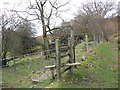
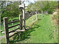
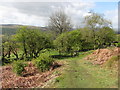
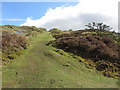
26 photos from this area
Area Information
Key information about the SA9 1TJ including its size, population, and administrative classification.
- Area Type
- Postcode
- Area Size
- 21.2 hectares
- Population
- 2082
- Population Density
- 19 people/km²
House Prices in SA9 1TJ
7
Properties
£282,500
Average Sold Price
£275,000
Lowest Price
£290,000
Highest Price
Showing 7 properties
| Address | Type | Beds | Baths | Last Sale Price | Last Sale Date | |
|---|---|---|---|---|---|---|
| The Spinney, Heol Tawe, Abercrave, Swansea, SA9 1TJ | Bungalow | - | - | £290,000 | Dec 2020 | |
| Abercrave Vicarage, 0 Heol Tawe, Abercrave, Swansea, SA9 1TJ | Detached | 5 | 4 | £275,000 | Mar 2015 | |
| Abercrave Farm, Heol Tawe, Abercrave, Swansea, SA9 1TJ | house | - | - | - | - | |
| Llys Y Coed, A 4067 From Western End Of Loop Road At St Davids Church To Brecon Road Abercraf, Abercrave, Swansea, SA9 1TJ | Detached | - | - | - | - | |
| Hafan Y Coed, A 4067 From Western End Of Loop Road At St Davids Church To Brecon Road Abercraf, Abercrave, Swansea, SA9 1TJ | Detached | - | - | - | - | |
| Abercrave House, Heol Tawe, Abercrave, Swansea, SA9 1TJ | Semi-detached | - | - | - | - | |
| Salon At, Hafan Y Coed, A 4067 From Western End Of Loop Road At St Davids Church To Brecon Road Abercraf, Abercrave, Swansea, SA9 1TJ | Office | - | - | - | - |
Energy Efficiency in SA9 1TJ
Amenities
Schools
| Rank | School | Type | Entry gender | Ages |
|---|
Explore more schools in this area
Go to Schools tabDemographics
Household Size
Two person
most common
Accommodation Type
Houses
most common
Tenure
78
majority
Ethnic Group
White
most common
Religion
N/A
most common
Household Composition
N/A
most common
Age
47
median
Adults (30-64 years)
most common
Household Deprivation
N/A
with no deprivation
NS-SEC
30
in Lower managerial occupations
Explore more demographic insights in this area
Go to Demographics tabPlanning
Planning Constraints
- Flood RiskPremium
- Ramsar Wetland SitesPremium
- Area of Outstanding Natural BeautyPremium
- Protected Nature ReservePremium
- Protected WoodlandPremium
- Crime RiskPremium