Area Overview for SA9 1LP
Photos of SA9 1LP
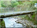
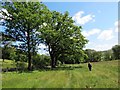
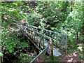

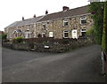
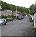
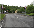
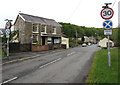
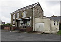
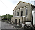
66 photos from this area
Area Information
Key information about the SA9 1LP including its size, population, and administrative classification.
- Area Type
- Postcode
- Area Size
- 9.9 hectares
- Population
- 1431
- Population Density
- 51 people/km²
House Prices in SA9 1LP
26
Properties
£159,996
Average Sold Price
£35,000
Lowest Price
£360,000
Highest Price
Showing 26 properties
| Address | Type | Beds | Baths | Last Sale Price | Last Sale Date | |
|---|---|---|---|---|---|---|
| Afallon, 50 Heol Giedd, Cwmgiedd, Ystradgynlais, SA9 1LP | Cottage | 4 | 2 | £360,000 | May 2023 | |
| Ash Cottage, 48 Heol Giedd, Cwmgiedd, Ystradgynlais, SA9 1LP | house | 3 | 1 | £266,500 | May 2022 | |
| 57 Heol Giedd, Cwmgiedd, Ystradgynlais, SA9 1LP | house | - | - | £181,500 | Jan 2022 | |
| 59 Heol Giedd, Cwmgiedd, Ystradgynlais, SA9 1LP | Terraced | 3 | 1 | £120,000 | Jul 2021 | |
| 71 Heol Giedd, Cwmgiedd, Ystradgynlais, SA9 1LP | house | - | - | £309,950 | Dec 2020 | |
| 55 Heol Giedd, Cwmgiedd, Ystradgynlais, SA9 1LP | Terraced | 2 | 1 | £105,000 | Nov 2018 | |
| Swn-yr-afon, Heol Giedd, Cwmgiedd, Ystradgynlais, SA9 1LP | house | - | - | £145,000 | Jun 2018 | |
| 53 Heol Giedd, Cwmgiedd, Ystradgynlais, SA9 1LP | Terraced | 2 | 1 | £70,000 | Jun 2016 | |
| 65 Heol Giedd, Cwmgiedd, Ystradgynlais, SA9 1LP | house | 2 | - | £92,000 | Apr 2010 | |
| 81 Heol Giedd, Cwmgiedd, Ystradgynlais, SA9 1LP | house | - | - | £136,000 | Jan 2010 |
Page 1 of 3
Energy Efficiency in SA9 1LP
Amenities
Schools
| Rank | School | Type | Entry gender | Ages |
|---|
Explore more schools in this area
Go to Schools tabDemographics
Household Size
Two person
most common
Accommodation Type
Houses
most common
Tenure
70
majority
Ethnic Group
White
most common
Religion
N/A
most common
Household Composition
N/A
most common
Age
47
median
Adults (30-64 years)
most common
Household Deprivation
N/A
with no deprivation
NS-SEC
29
in Lower managerial occupations
Explore more demographic insights in this area
Go to Demographics tabPlanning
Planning Constraints
- Flood RiskPremium
- Ramsar Wetland SitesPremium
- Area of Outstanding Natural BeautyPremium
- Protected Nature ReservePremium
- Protected WoodlandPremium
- Crime RiskPremium