Area Overview for SA9 1HB
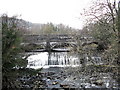
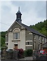
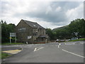
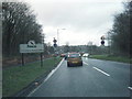
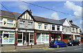
Photos of SA9 1HB


Area Information
Living in SA9 1HB means residing in a specific residential cluster within Wales that captures a distinct slice of daily life for 2,064 residents. This postcode area is characterised by a population density of 543 people per square kilometre, creating a compact community where neighbours are close by. The area is defined by its established nature rather than rapid expansion, offering a stable environment for those who prioritise quiet living over urban excitement. For a prospective buyer, living in SA9 1HB provides access to a neighbourhood with clear boundaries and a specific local identity. The setting avoids the chaos of major cities, yet it maintains sufficient proximity to necessary services without overwhelming the pace of life. You will find a community where the rhythm is set by local routines rather than commuter traffic or tourist influxes. The area's size ensures that walks to local hubs are manageable, fostering a sense of familiarity among long-term residents. Homebuyers looking for a straightforward address with fewer complications here will appreciate the directness of this cluster. The physical layout supports a grounded lifestyle where community interaction remains possible without the strain of overcrowded streets. This makes SA9 1HB a practical choice for individuals seeking a slice of domestic peace in South Wales.
- Area Type
- Postcode
- Area Size
- Not available
- Population
- 2064
- Population Density
- 543 people/km²
The property market in SA9 1HB is dominated by houses, creating a distinct contrast to urban areas filled with flats and apartments. With 75 percent of homes being owner-occupied, the area functions less as a rental market and more as a settled residential zone. This high ownership rate implies that the housing stock attracts buyers who plan to stay long term, rather than investors seeking quick flips or short-term lets. For someone looking at homes in SA9 1HB, the expectation should be that properties are primarily single-family dwellings designed for permanence. The accommodation type is exclusively houses, meaning you will not find detached mansions or terraced rows mixed with high-rise blocks in this postcode. The market reflects a specific demographic need where homeownership is the standard rather than the exception. Buyers entering this market should anticipate prices reflecting the cost of establishing a home rather than rent arbitrage. The prevalence of ownership suggests a community where care for the property is intrinsic to the culture of SA9 1HB. When evaluating a home here, focus on the structural integrity and garden space typical of a house rather than interpreting layouts designed for rental efficiency.
House Prices in SA9 1HB
No properties found in this postcode.
Energy Efficiency in SA9 1HB
Daily life in SA9 1HB centres on practical access to essential retail outlets rather than leisure complexes or cultural venues. Within practical reach, residents have access to five main retail points, specifically Tesco Ystradgynlais, Asda Ystalyfera, and Morrisons Daily. These supermarkets provide the bulk of weekly shopping needs, meaning you do not need to travel far for groceries or household essentials. The presence of these named stores indicates that the area is supported by larger regional hubs rather than isolated convenience stores only. Dining options and independent boutiques are not detailed in the immediate amenity list, suggesting a reliance on the larger supermarkets for some food and general goods purchases. The convenience of Tesco Ystradgynlais and Asda Ystalyfera allows for efficient errand running without long commutes into city centres. For those living in SA9 1HB, the lifestyle is defined by this reliable access to food and basic consumer goods. There is no data provided on cinemas, gyms, or restaurants in this immediate cluster, so activities likely extend beyond these specific retail points. You can expect a self-sufficient lifestyle where the nearest stores dictate the rhythm of your weekly trip schedule.
Amenities
Schools
Families in SA9 1HB rely on two nearby educational institutions for their children's upbringing. Ysgol Gymraeg Ynyscedwyn serves as a key local school option for those prioritising Welsh-language education, though its specific Ofsted rating is not listed in current records. Parents should also consider Ysgol Maes-Y-Dderwen, which operates as another local school within practical reach. The presence of these two schools suggests a location where educational needs are met through existing institutions rather than requiring long commutes to larger hubs. While the type of each school is listed as 'other' in the available data, the names indicate a strong connection to local heritage and language communities. For families moving to SA9 1HB, the decision often hinges on travel time to these specific grounds rather than a wide array of choices within the immediate postcode. The mix of schools implies that families might need to factor in distance when selecting which institution to enrol their children at. Access to schools near SA9 1HB is therefore defined by proximity to these two named establishments. Prospective homebuyers must verify their preferred school's catchment area against their specific address within these clusters.
| Rank | School | Type | Entry gender | Ages |
|---|
Explore more schools in this area
Go to Schools tabDemographics
The demographic profile of SA9 1HB reveals a community anchored by established households. The median age sits at 47 years, confirming that adults between the ages of 30 and 64 constitute the most common age range. This indicates that the area has aged naturally over time, with fewer young families moving in compared to younger retirees or first-time buyers. Consequently, the local scene reflects a mature population that values stability and established routines. Home ownership stands at 75 percent, showing that three quarters of residents own their properties outright or have mortgages. This high rate suggests a deeply settled community with few short-term tenants or transient workers passing through. The prevailing accommodation type consists of houses rather than flats, which aligns with the preference for standalone living spaces among this age group. Diversity in the population is reflected by White being the predominant ethnic group according to available records. These figures paint a picture of a traditional, property-owning community where long-term residence is the norm. You will see a neighbourhood where change is gradual, with homeownership driving the social fabric of SA9 1HB.
Household Size
Accommodation Type
Tenure
Ethnic Group
Religion
Household Composition
Age
Household Deprivation
NS-SEC
Explore more demographic insights in this area
Go to Demographics tabPlanning
Planning Constraints
- Flood RiskPremium
- Ramsar Wetland SitesPremium
- Area of Outstanding Natural BeautyPremium
- Protected Nature ReservePremium
- Protected WoodlandPremium
- Crime RiskPremium