Area Overview for SA9 1GS
Photos of SA9 1GS
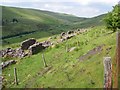
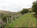
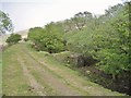
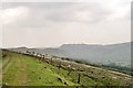
4 photos from this area
Area Information
Key information about the SA9 1GS including its size, population, and administrative classification.
- Area Type
- Postcode
- Area Size
- 5.8 km²
- Population
- 1747
- Population Density
- 7 people/km²
House Prices in SA9 1GS
4
Properties
£1,218,045
Average Sold Price
£1,218,045
Lowest Price
£1,218,045
Highest Price
Showing 4 properties
| Address | Type | Beds | Baths | Last Sale Price | Last Sale Date | |
|---|---|---|---|---|---|---|
| Blaen Twyni Farm, Blaentwyni Road, Penycae, Swansea, SA9 1GS | Semi-detached | - | - | £1,218,045 | Aug 2023 | |
| Swn Yr Afon, A 4067 From Junction With Heol Callwen At Glyntawe To Junction With U 0335 At Fan Cottage, Penycae, Swansea, SA9 1GS | Bungalow | 2 | - | - | - | |
| Maes-yr-eglwys, A 4067 From Junction With Heol Callwen At Glyntawe To Junction With U 0335 At Fan Cottage, Penycae, Swansea, SA9 1GS | house | - | - | - | - | |
| Dwr Cymru Welsh Water, Water Treatment Works, Blaentwyni Road, Penycae, Swansea, SA9 1GS | Industrial | - | - | - | - |
Energy Efficiency in SA9 1GS
Amenities
Schools
| Rank | School | Type | Entry gender | Ages |
|---|
Explore more schools in this area
Go to Schools tabDemographics
Household Size
Two person
most common
Accommodation Type
Houses
most common
Tenure
73
majority
Ethnic Group
White
most common
Religion
N/A
most common
Household Composition
N/A
most common
Age
47
median
Adults (30-64 years)
most common
Household Deprivation
N/A
with no deprivation
NS-SEC
33
in Lower managerial occupations
Explore more demographic insights in this area
Go to Demographics tabPlanning
Planning Constraints
- Flood RiskPremium
- Ramsar Wetland SitesPremium
- Area of Outstanding Natural BeautyPremium
- Protected Nature ReservePremium
- Protected WoodlandPremium
- Crime RiskPremium