Area Overview for Painscastle Community
Photos of Painscastle Community
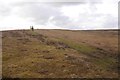
Area Information
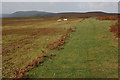
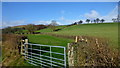
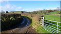
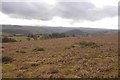
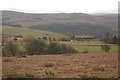
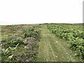
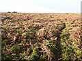
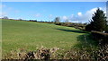
Painscastle Community sits in the heart of Wales, covering an area of 54.9 km². You will find this civil parish is defined by its rural character rather than urban density. The landscape here is shaped by significant environmental features, including spaces designated as protected woodland and nature reserves. These constraints play a major role in the daily life of residents and influence how the land is used. Living in Painscastle Community means embracing a set-back from the main centres of activity. The location is not a bustling town but a quiet parish where the environment itself is the primary asset. This setup suits those seeking seclusion over convenience. You should understand that daily activities like shopping or visiting larger amenities require travel beyond the parish boundaries. The quiet nature of the area is its strongest feature for some buyers. However, the extensive protected sites also mean development options are extremely limited. Prospective buyers looking for a traditional village feel with immediate access to town centres may find the geography here too remote. The description as a parish signals a local governance structure that manages these green spaces. This context is vital when you weigh the pros and cons of moving to Painscastle Community.
- Area Type
- Parish
- Area Size
- 54.9 km²
- Population
- Not available
- Population Density
- Not available
Demographics
The demographic profile of Painscastle Community is distinctly older than most of the UK. You will find the median age of residents is 70 years. This high age figure indicates an area populated primarily by retirees rather than young families or working-age adults. The most common age range within the data is listed simply as Age Total, but the central tendency points clearly to an elderly population. Home ownership rates here reach 77 per cent. This high percentage of owners suggests that many residents have settled permanently in the area after retiring. You will find few private landlords operating within the parish due to this dominance of owner-occupied stock. The data does not break down specific household compositions or predominant ethnic groups in the provided figures. Consequently, you should assume a neighbourhood that reflects broader trends for retirement destinations in Wales rather than a diverse, mixed-income locality. This demographic reality shapes the local economy and social activities. Community life revolves around those who have moved here for stability and quiet. It is a demographic landscape that matches your needs if you are seeking peace, but it will not appeal if you require a vibrant mix of people in their working lives.
Household Size
Accommodation Type
Tenure
Ethnic Group
Religion
Household Composition
Age
Household Deprivation
NS-SEC
Explore more demographic insights in this area
Go to Demographics tabPlanning
Planning Constraints
- Flood RiskPremium
- Ramsar Wetland SitesPremium
- Area of Outstanding Natural BeautyPremium
- Protected Nature ReservePremium
- Protected WoodlandPremium
- Crime RiskPremium