Area Overview for NP8 1ND
Photos of NP8 1ND
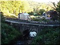
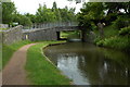
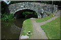
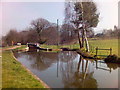
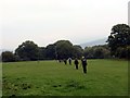
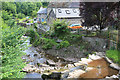
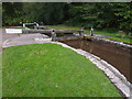
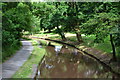
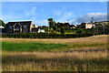
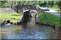
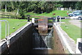
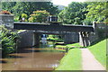
100 photos from this area
Area Information
Key information about the NP8 1ND including its size, population, and administrative classification.
- Area Type
- Postcode
- Area Size
- 12.2 hectares
- Population
- 1035
- Population Density
- 21 people/km²
House Prices in NP8 1ND
3
Properties
£297,250
Average Sold Price
£199,500
Lowest Price
£395,000
Highest Price
Showing 3 properties
| Address | Type | Beds | Baths | Last Sale Price | Last Sale Date | |
|---|---|---|---|---|---|---|
| Lock Cottage, B 4558 From Cwm Crawnon Road Llangynidr To Junction With U 560 By Lock House, Llangynidr, Crickhowell, NP8 1ND | Detached | - | - | £395,000 | Sep 2016 | |
| Cwm House, B 4558 From Cwm Crawnon Road Llangynidr To Junction With U 560 By Lock House, Llangynidr, Crickhowell, NP8 1ND | Detached | 4 | - | £199,500 | Nov 2002 | |
| Cwm Crawnon Warehouse, U 0560 From Spur Joining B 4558 Near Pont Crawnon Via Maes Y Beddau To Junction With C 0143, Llangynidr, Crickhowell, NP8 1ND | office_workshop | - | - | - | - |
Energy Efficiency in NP8 1ND
Amenities
Schools
| Rank | School | Type | Entry gender | Ages |
|---|
Explore more schools in this area
Go to Schools tabDemographics
Household Size
Two person
most common
Accommodation Type
Houses
most common
Tenure
79
majority
Ethnic Group
White
most common
Religion
N/A
most common
Household Composition
N/A
most common
Age
47
median
Adults (30-64 years)
most common
Household Deprivation
N/A
with no deprivation
NS-SEC
45
in Lower managerial occupations
Explore more demographic insights in this area
Go to Demographics tabPlanning
Planning Constraints
- Flood RiskPremium
- Ramsar Wetland SitesPremium
- Area of Outstanding Natural BeautyPremium
- Protected Nature ReservePremium
- Protected WoodlandPremium
- Crime RiskPremium