Area Overview for Llansilin Community
Photos of Llansilin Community

Area Information
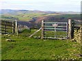
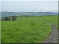
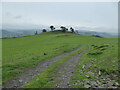
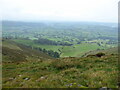
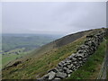
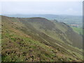
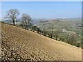
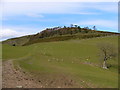
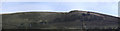
Living in Llansilin Community offers a distinct experience defined by its rural character and significant size. As a civil parish spanning 47.5 square kilometres, this area provides ample space and a generally quiet atmosphere away from the noise of major towns. The population profile suggests a mature community where daily life moves at a relaxed pace, which might appeal to those seeking calm surroundings rather than urban energy. You will find yourself in a location where the landscape plays a central role in your daily routine, offering plenty of room for walking and exploration without the congestion found in busier Welsh counties. The sheer scale of the parish ensures that amenities are spread out, meaning you need to plan your outings carefully but can enjoy open skies and a strong sense of isolation from city life. Choosing to live here means embracing a slower lifestyle where neighbours know each other well and local events often centre on traditions rather than commercial developments. The area lacks the demographic energy of a young university town or a commuter hub, instead reflecting the patterns of a settled, long-term resident population. This stability creates a predictable environment where property values and community standards tend to remain consistent year after year. If you value privacy and large gardens over proximity to high street shopping, Llansilin Community presents a practical option. The location suits buyers who prioritise space and tranquility over immediate access to major transport links or night-time entertainment venues.
- Area Type
- Parish
- Area Size
- 47.5 km²
- Population
- Not available
- Population Density
- Not available
Demographics
The community within Llansilin Community reflects a notably mature demographic profile. Residents here represent an older generation, with a median age of seventy years. This statistic confirms that the area functions primarily as a retirement destination or a place for those who have moved from larger cities after raising their families. There is no indication of a youthful population entering the local economy, suggesting a static social structure where long-term families and retired couples dominate the neighbourhood. Such a profile influences local services, as schools may cater to younger populations in nearby towns while Llansilin itself serves its elderly residents. Home ownership stands at seventy-five per cent, indicating that most households own their homes outright or via mortgage rather than renting. This high level of ownership aligns with the older population, as people in this age group typically retain their properties against optioning them for tenures. The constituency remains predominantly total, meaning the data covers the entire parish without splitting into administrative sub-areas for this specific report. While the area shows diversity markers for a Welsh village, the most common age range remains the total population bracket, reinforcing the single-age-dominant nature of the settlement. These figures suggest that if you are looking to move into Llansilin Community, you are likely joining a group of peers who prioritise stability, established hobbies, and quiet living over the dynamism found in areas with a younger workforce.
Household Size
Accommodation Type
Tenure
Ethnic Group
Religion
Household Composition
Age
Household Deprivation
NS-SEC
Explore more demographic insights in this area
Go to Demographics tabPlanning
Planning Constraints
- Flood RiskPremium
- Ramsar Wetland SitesPremium
- Area of Outstanding Natural BeautyPremium
- Protected Nature ReservePremium
- Protected WoodlandPremium
- Crime RiskPremium