Area Overview for Llanbister Community
Photos of Llanbister Community
Area Information
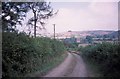
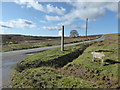
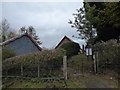
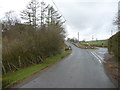
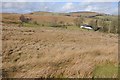
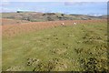
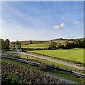
Living in Llanbister Community offers a distinct experience within the civil parish of Wales. This area spans 58.1 square kilometres, providing a significant expanse of countryside compared to typical urban settlements. You are looking at a location that functions as a defined parish rather than a dense town centre. The sheer size of the land allows for a slower pace of life, yet it remains a formally recognised community unit. Daily life here is dictated by this rural character and the specific boundaries that define the parish. Prospective buyers considering homes in Llanbister Community must understand the scale of the terrain they will inhabit. The local environment is open and expansive, which suits those seeking space over proximity to city centres. You will find that the identity of the area is tied closely to its status as a civil parish, a fact that shapes local governance and community focus. This region is not part of an urban conurbation or a protected landscape such as an Area of Outstanding Natural Beauty, according to current records. Instead, it stands as an independent entity with its own geographical footprint. When you move here, you enter a setting defined by its width and its administrative classification. The 58.1 square kilometre footprint ensures that routes are relatively few, and distances between points of interest can be significant. This physical reality forms the backbone of the daily routine for anyone calling Llanbister Community their home. It is a place where the layout of the land dictates the rhythm of life.
- Area Type
- Parish
- Area Size
- 58.1 km²
- Population
- Not available
- Population Density
- Not available
Demographics
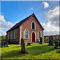
The community in Llanbister Community is characterised by an older population profile. The median age stands at 70 years old, marking a distinct demographic shift from national averages. This high median age suggests that you are likely to find a resident base composed of retirees or long-term residents rather than young families or students. There is no specific data available to highlight the most common age range beyond this central figure, but the skew is clear. Home ownership levels in the area are substantial, with 77 per cent of residents owning their property. This indicates a settled market where families have a generation to call this home theirs. The high ownership rate reflects the demographic reality that older residents typically stay in one location for decades. Households are structured around these long-term owners, creating a stable local network. Ethnic diversity and religious composition data are not available in the current records for this specific parish. Likewise, detailed breakdowns of predominant ethnic groups remain unspecified. You must rely on the demographic sense implied by the age and ownership figures. The absence of detailed diversity statistics does not change the fundamental nature of the population, which is heavily weighted toward the elderly. When considering living in Llanbister Community, assume an environment shaped by an ageing population with strong property ties.
Household Size
Accommodation Type
Tenure
Ethnic Group
Religion
Household Composition
Age
Household Deprivation
NS-SEC
Explore more demographic insights in this area
Go to Demographics tabPlanning
Planning Constraints
- Flood RiskPremium
- Ramsar Wetland SitesPremium
- Area of Outstanding Natural BeautyPremium
- Protected Nature ReservePremium
- Protected WoodlandPremium
- Crime RiskPremium