Area Overview for LD8 2TL
Photos of LD8 2TL


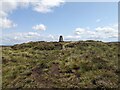
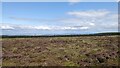


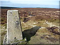
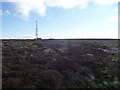
30 photos from this area
Area Information
Key information about the LD8 2TL including its size, population, and administrative classification.
- Area Type
- Postcode
- Area Size
- 14.9 km²
- Population
- 1683
- Population Density
- 11 people/km²
House Prices in LD8 2TL
15
Properties
£252,444
Average Sold Price
£125,000
Lowest Price
£360,000
Highest Price
Showing 15 properties
| Address | Type | Beds | Baths | Last Sale Price | Last Sale Date | |
|---|---|---|---|---|---|---|
| Quarry House, Mutton Dingle, New Radnor, Presteigne, LD8 2TL | Retail | 2 | 2 | £360,000 | Nov 2022 | |
| Fircroft, Mutton Dingle, New Radnor, Presteigne, LD8 2TL | Detached | 4 | 2 | £340,000 | Jul 2021 | |
| Mimulus, Mutton Dingle, New Radnor, Presteigne, LD8 2TL | Bungalow | - | - | £250,000 | Nov 2018 | |
| Little Folley, Mutton Dingle, New Radnor, Presteigne, LD8 2TL | Cottage | 3 | - | £345,000 | Feb 2015 | |
| Well Cottage, 0 Mutton Dingle, New Radnor, Presteigne, LD8 2TL | Detached | 3 | - | £230,000 | May 2013 | |
| Old Mill Pond, Mutton Dingle, New Radnor, Presteigne, LD8 2TL | Bungalow | - | - | £245,000 | Aug 2010 | |
| Homeleigh, Mutton Dingle, New Radnor, Presteigne, LD8 2TL | Detached | - | - | £125,000 | Jun 2009 | |
| Bwthyn Cwmbroddel, Mutton Dingle, New Radnor, Presteigne, LD8 2TL | Detached | - | - | £177,000 | Feb 2004 | |
| Castle Cottage, Mutton Dingle, New Radnor, Presteigne, LD8 2TL | house | - | - | £200,000 | Nov 2003 | |
| Hill House, Mutton Dingle, New Radnor, Presteigne, LD8 2TL | Detached | - | - | - | - |
Page 1 of 2
Energy Efficiency in LD8 2TL
Amenities
Schools
| Rank | School | Type | Entry gender | Ages |
|---|
Explore more schools in this area
Go to Schools tabDemographics
Household Size
Two person
most common
Accommodation Type
Houses
most common
Tenure
76
majority
Ethnic Group
White
most common
Religion
N/A
most common
Household Composition
N/A
most common
Age
47
median
Adults (30-64 years)
most common
Household Deprivation
N/A
with no deprivation
NS-SEC
31
in Lower managerial occupations
Explore more demographic insights in this area
Go to Demographics tabPlanning
Planning Constraints
- Flood RiskPremium
- Ramsar Wetland SitesPremium
- Area of Outstanding Natural BeautyPremium
- Protected Nature ReservePremium
- Protected WoodlandPremium
- Crime RiskPremium