Area Overview for LD7 1SD
Photos of LD7 1SD
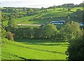
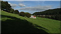
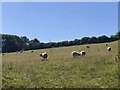
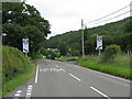
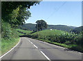
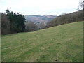
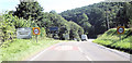
11 photos from this area
Area Information
Key information about the LD7 1SD including its size, population, and administrative classification.
- Area Type
- Postcode
- Area Size
- 10.5 hectares
- Population
- 1395
- Population Density
- 97 people/km²
House Prices in LD7 1SD
10
Properties
£240,000
Average Sold Price
£170,000
Lowest Price
£310,000
Highest Price
Showing 10 properties
| Address | Type | Beds | Baths | Last Sale Price | Last Sale Date | |
|---|---|---|---|---|---|---|
| Five Ways, Woodhouse Lane, Rhos Y Meirch, Knighton, LD7 1SD | Detached | 3 | 2 | £310,000 | Aug 2018 | |
| The Jackets, 0 Penybont Road, Knighton, LD7 1SD | Land | - | - | £170,000 | Dec 2001 | |
| Team Valley Hunt Kennels, A 488 From Penybont Road Knighton To Junction With C 1075, Knighton, LD7 1SD | commercial | - | - | - | - | |
| F M Caine And Sons, Office, The Factory, Penybont Road, Knighton, LD7 1SD | Office | - | - | - | - | |
| 2, The Kennels, A 488 From Penybont Road Knighton To Junction With C 1075, Knighton, LD7 1SD | house | - | - | - | - | |
| 1, The Kennels, A 488 From Penybont Road Knighton To Junction With C 1075, Knighton, LD7 1SD | Semi-detached | 3 | 1 | - | - | |
| Unit C, The Factory, Penybont Road, Knighton, LD7 1SD | Industrial | - | - | - | - | |
| Laminate Technology, Gwernaffel Unit, The Factory, Penybont Road, Knighton, LD7 1SD | Industrial | - | - | - | - | |
| Unit B, The Factory, Penybont Road, Knighton, LD7 1SD | Industrial | - | - | - | - | |
| Workshop And Premises, The Factory, Penybont Road, Knighton, LD7 1SD | Industrial | - | - | - | - |
Energy Efficiency in LD7 1SD
Amenities
Schools
| Rank | School | Type | Entry gender | Ages |
|---|
Explore more schools in this area
Go to Schools tabDemographics
Household Size
Two person
most common
Accommodation Type
Houses
most common
Tenure
70
majority
Ethnic Group
White
most common
Religion
N/A
most common
Household Composition
N/A
most common
Age
47
median
Adults (30-64 years)
most common
Household Deprivation
N/A
with no deprivation
NS-SEC
23
in Lower managerial occupations
Explore more demographic insights in this area
Go to Demographics tabPlanning
Planning Constraints
- Flood RiskPremium
- Ramsar Wetland SitesPremium
- Area of Outstanding Natural BeautyPremium
- Protected Nature ReservePremium
- Protected WoodlandPremium
- Crime RiskPremium