Area Overview for LD7 1LF
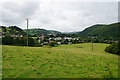
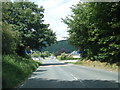
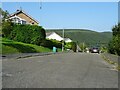
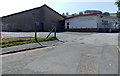
Photos of LD7 1LF
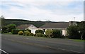
![Wanderings around the Welsh/English border [116] in LD7 1LF](https://images.propbar.co.uk/images/geograph/69/90/6990458_120.jpg)
20 photos from this area
Area Information
Key information about the LD7 1LF including its size, population, and administrative classification.
- Area Type
- Postcode
- Area Size
- 2.5 hectares
- Population
- 1516
- Population Density
- 128 people/km²
House Prices in LD7 1LF
45
Properties
£146,137
Average Sold Price
£35,000
Lowest Price
£250,000
Highest Price
Showing 45 properties
| Address | Type | Beds | Baths | Last Sale Price | Last Sale Date | |
|---|---|---|---|---|---|---|
| 47 Seven Acres, Knighton, LD7 1LF | Terraced | 2 | - | £145,000 | Mar 2025 | |
| 20 Seven Acres, Knighton, LD7 1LF | house | - | - | £175,000 | Jan 2025 | |
| 35 Seven Acres, Knighton, LD7 1LF | house | - | - | £162,000 | Feb 2023 | |
| 30 Seven Acres, Knighton, LD7 1LF | Bungalow | 3 | 1 | £240,000 | Feb 2023 | |
| 43 Seven Acres, Knighton, LD7 1LF | Terraced | 3 | 1 | £150,000 | Oct 2022 | |
| 34 Seven Acres, Knighton, LD7 1LF | Terraced | 3 | 1 | £181,000 | Jun 2022 | |
| 15 Seven Acres, Knighton, LD7 1LF | Bungalow | - | - | £250,000 | May 2022 | |
| 1 Seven Acres, Knighton, LD7 1LF | house | - | - | £215,000 | Apr 2021 | |
| 56 Seven Acres, Knighton, LD7 1LF | Bungalow | 3 | - | £185,000 | Jan 2021 | |
| 7 Seven Acres, Knighton, LD7 1LF | Bungalow | - | - | £219,000 | Oct 2020 |
Page 1 of 5
Energy Efficiency in LD7 1LF
Amenities
Schools
| Rank | School | Type | Entry gender | Ages |
|---|
Explore more schools in this area
Go to Schools tabDemographics
Household Size
One person
most common
Accommodation Type
Houses
most common
Tenure
63
majority
Ethnic Group
White
most common
Religion
N/A
most common
Household Composition
N/A
most common
Age
47
median
Adults (30-64 years)
most common
Household Deprivation
N/A
with no deprivation
NS-SEC
27
in Lower managerial occupations
Explore more demographic insights in this area
Go to Demographics tabPlanning
Planning Constraints
- Flood RiskPremium
- Ramsar Wetland SitesPremium
- Area of Outstanding Natural BeautyPremium
- Protected Nature ReservePremium
- Protected WoodlandPremium
- Crime RiskPremium