Area Overview for LD7 1HS
Photos of LD7 1HS
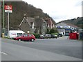
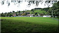
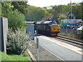
![Knighton buildings [1] in LD7 1HS](https://images.propbar.co.uk/images/geograph/69/38/6938692_120.jpg)
85 photos from this area
Area Information
Key information about the LD7 1HS including its size, population, and administrative classification.
- Area Type
- Postcode
- Area Size
- 2.0 hectares
- Population
- 1516
- Population Density
- 128 people/km²
House Prices in LD7 1HS
25
Properties
£113,342
Average Sold Price
£38,000
Lowest Price
£185,000
Highest Price
Showing 25 properties
| Address | Type | Beds | Baths | Last Sale Price | Last Sale Date | |
|---|---|---|---|---|---|---|
| 25 Pontfaen, Knighton, LD7 1HS | Semi-detached | 3 | 1 | £185,000 | Apr 2025 | |
| 20 Pontfaen, Knighton, LD7 1HS | Terraced | 3 | 1 | £153,000 | Apr 2020 | |
| 14 Pontfaen, Knighton, LD7 1HS | house | - | - | £109,050 | Mar 2019 | |
| 21 Pontfaen, Knighton, LD7 1HS | Terraced | - | - | £145,000 | Aug 2007 | |
| 4 Ludlow Road, Knighton, LD7 1HS | Terraced | - | - | £50,000 | Nov 2001 | |
| 6 Pontfaen, Knighton, LD7 1HS | Semi-detached | - | - | £38,000 | Dec 1996 | |
| 16 Pontfaen, Knighton, LD7 1HS | house | - | - | - | - | |
| 19 Pontfaen, Knighton, LD7 1HS | Semi-detached | - | - | - | - | |
| 23 Pontfaen, Knighton, LD7 1HS | house | - | - | - | - | |
| 12 Pontfaen, Knighton, LD7 1HS | Terraced | - | - | - | - |
Page 1 of 3
Energy Efficiency in LD7 1HS
Amenities
Schools
| Rank | School | Type | Entry gender | Ages |
|---|
Explore more schools in this area
Go to Schools tabDemographics
Household Size
One person
most common
Accommodation Type
Houses
most common
Tenure
63
majority
Ethnic Group
White
most common
Religion
N/A
most common
Household Composition
N/A
most common
Age
47
median
Adults (30-64 years)
most common
Household Deprivation
N/A
with no deprivation
NS-SEC
27
in Lower managerial occupations
Explore more demographic insights in this area
Go to Demographics tabPlanning
Planning Constraints
- Flood RiskPremium
- Ramsar Wetland SitesPremium
- Area of Outstanding Natural BeautyPremium
- Protected Nature ReservePremium
- Protected WoodlandPremium
- Crime RiskPremium